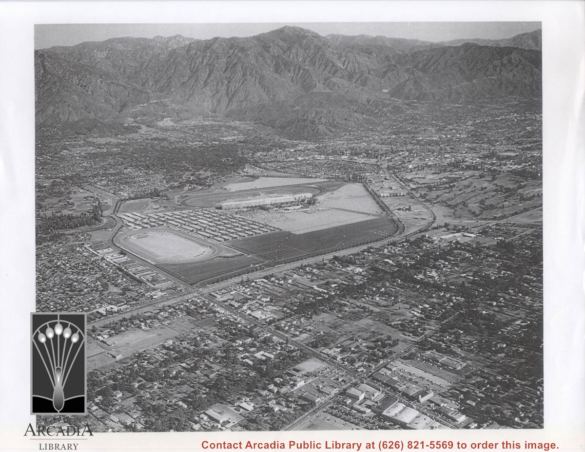
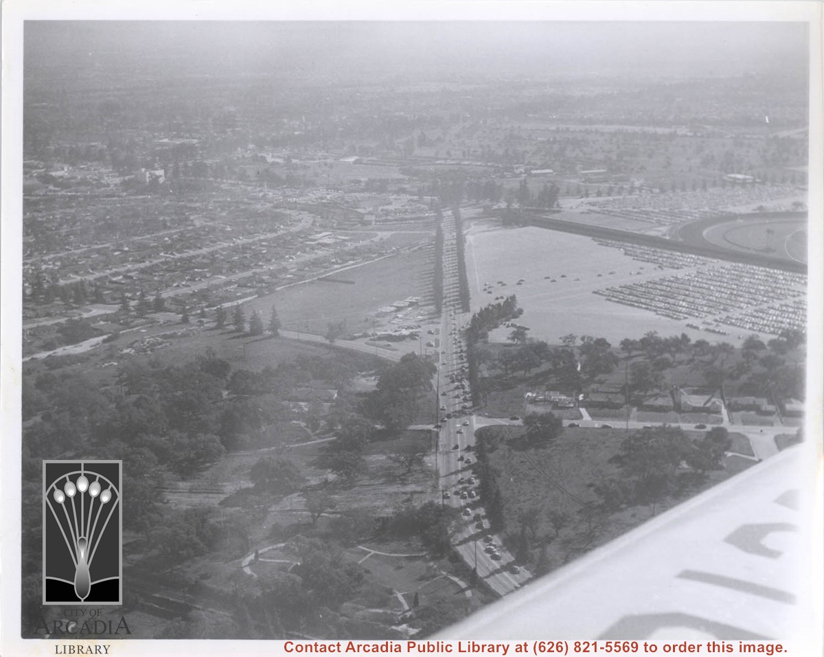
Aerial view toward north from a position south of Huntington Drive near intersection with Baldwin Avenue. It shows Santa Anita Fashion Park (currently known as Westfield Santa Anita Shopping Mall) developed by and on property owned by Santa Anita Consolidated. The Santa Anita Park Race Track and club house can be seen in center of photo. The straight white line about one inch above the club house roof is 210 Foothill Freeway. Chantry Flats road can be seen going up into San Gabriel Mountains in distance.
https://arcadiahistory.andornot.com/en/permalink/photographs646
- Date
- c. 1975
1 image
- Date
- c. 1975
- Subjects
- Aerial Photo Collection
- Aerial views
- 210 Foothill Freeway
- Chantry Flats Road
- Malls
- San Gabriel Mountains
- Santa Anita Park-1945-1980
- Santa Anita Fashion Park
- Westfield Santa Anita Shopping Mall
- Physical Description
- 8x10 b&w
- ID
- 642
- Collection
- Photographs
Images


Aerial view looking towards San Gabriel Mountains showing intersection of Baldwin Avenue and Huntington Drive, the Santa Anita Park and training track where Santa Anita Fashion Park (currently known as Westfield Santa Anita Shopping Mall) was built.
https://arcadiahistory.andornot.com/en/permalink/photographs1754
- Date
- Unknown
1 image
- Date
- Unknown
- Subjects
- Aerial Photo Collection
- Aerial views
- Baldwin Avenue
- Huntington Drive
- Malls
- San Gabriel Mountains
- Santa Anita Fashion Park
- Santa Anita Park, 1945-1980
- Westfield Santa Anita Shopping Mall
- Physical Description
- 8x10 b&w photocopy
- ID
- 1742
- Collection
- Photographs
Images
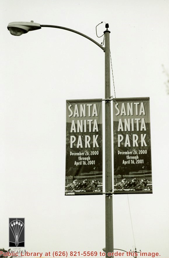
Double banners advertising Santa Anita Park horse racing December 26, 2000 through April 16, 2001 on lampposts. Photo by Terry Miller.
https://arcadiahistory.andornot.com/en/permalink/photographs2356
- Date
- 2001
1 image
- Date
- 2001
- Subjects
- Santa Anita Park (2001-2010)
- Physical Description
- 4x6 b&w
- ID
- 2252A
- Collection
- Photographs
Images
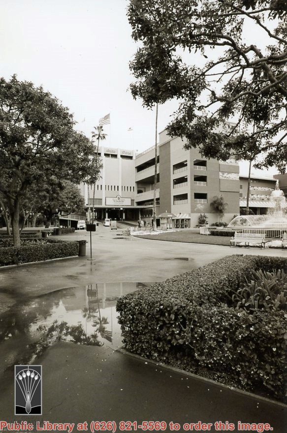
Santa Anita Park entrance with fountain on the right. Photo by Terry Miller.
https://arcadiahistory.andornot.com/en/permalink/photographs2357
- Date
- 2001
1 image
- Date
- 2001
- Subjects
- Santa Anita Park (2001-2010)
- Physical Description
- 4x6 b&w
- ID
- 2252B
- Collection
- Photographs
Images
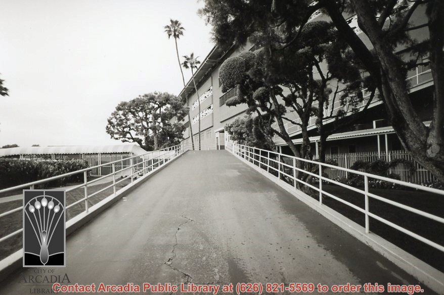
Walkway up to Santa Anita Park. Photo by Terry Miller.
https://arcadiahistory.andornot.com/en/permalink/photographs2358
- Date
- 2001
1 image
- Date
- 2001
- Subjects
- Santa Anita Park (2001-2010)
- Physical Description
- 4x6 b&w
- ID
- 2252C
- Collection
- Photographs
Images
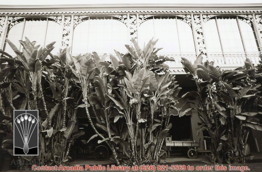
A building at Santa Anita Park with decorative leaves forming the arches and scalloped design over the arches. Photo by Terry Miller.
https://arcadiahistory.andornot.com/en/permalink/photographs2359
- Date
- 2001
1 image
- Date
- 2001
- Subjects
- Santa Anita Park (2001-2010)
- Physical Description
- 4x6 b&w
- ID
- 2252D
- Collection
- Photographs
Images
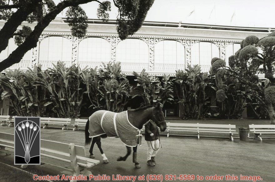
A person walks a horse in front of the building at Santa Anita Park with decorative leaves forming the arches and scalloped design over the arches. Benches for seating. Horse is wearing a cape. Photo by Terry Miller.
https://arcadiahistory.andornot.com/en/permalink/photographs2360
- Date
- 2001
1 image
- Date
- 2001
- Subjects
- Santa Anita Park (2001-2010)
- Physical Description
- 4x6 b&w
- ID
- 2253A
- Collection
- Photographs
Images
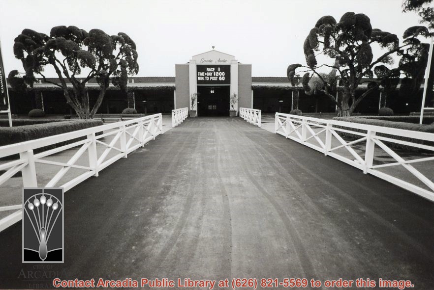
A building at Santa Anita Park with sign announcing time of next race. Photo by Terry Miller.
https://arcadiahistory.andornot.com/en/permalink/photographs2361
- Date
- 2001
1 image
- Date
- 2001
- Subjects
- Santa Anita Park (2001-2010)
- Physical Description
- 4x6 b&w
- ID
- 2253B
- Collection
- Photographs
Images
A view of Santa Anita Park buildings and fountain. Photo by Terry Miller.
https://arcadiahistory.andornot.com/en/permalink/photographs2362
- Date
- 2001
1 image
- Date
- 2001
- Subjects
- Santa Anita Park (2001-2010)
- Physical Description
- 4x6 b&w
- ID
- 2253C
- Collection
- Photographs
Images
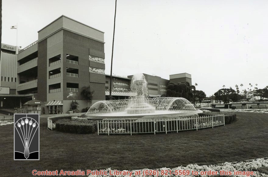
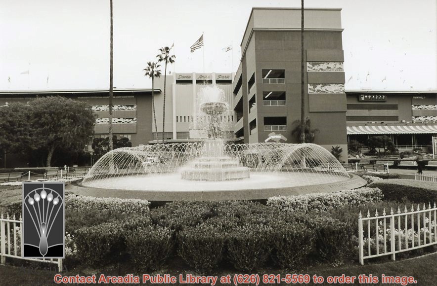
A view of Santa Anita Park entrance and fountain. Photo by Terry Miller.
https://arcadiahistory.andornot.com/en/permalink/photographs2363
- Date
- 2001
1 image
- Date
- 2001
- Subjects
- Santa Anita Park (2001-2010)
- Physical Description
- 4x6 b&w
- ID
- 2253D
- Collection
- Photographs
Images
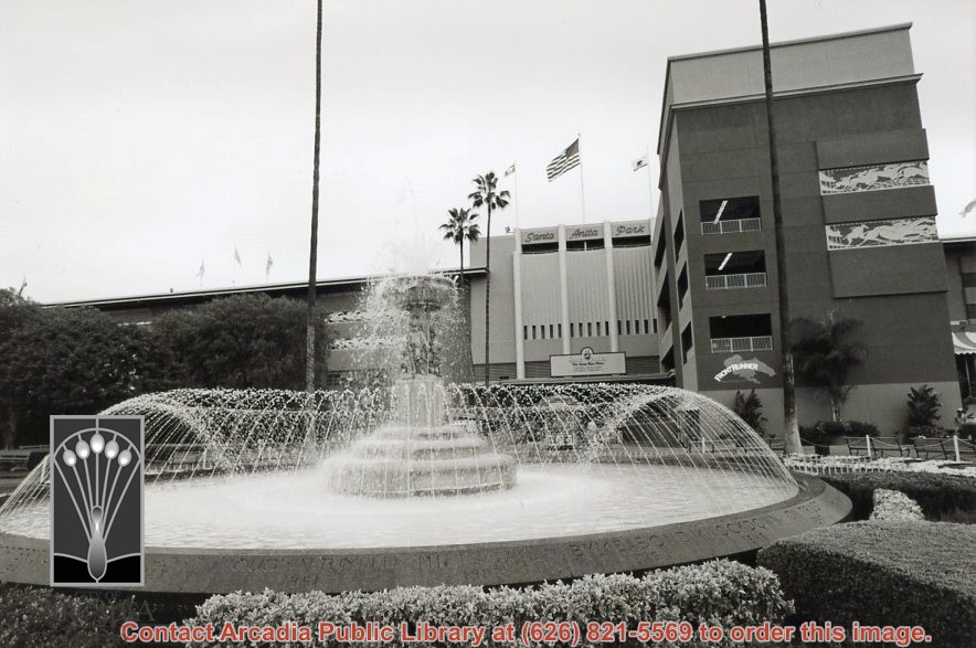
A view of Santa Anita Park entrance and fountain. Photo by Terry Miller.
https://arcadiahistory.andornot.com/en/permalink/photographs2364
- Date
- 2001
1 image
- Date
- 2001
- Subjects
- Santa Anita Park (2001-2010)
- Physical Description
- 4x6 b&w
- ID
- 2254A
- Collection
- Photographs
Images
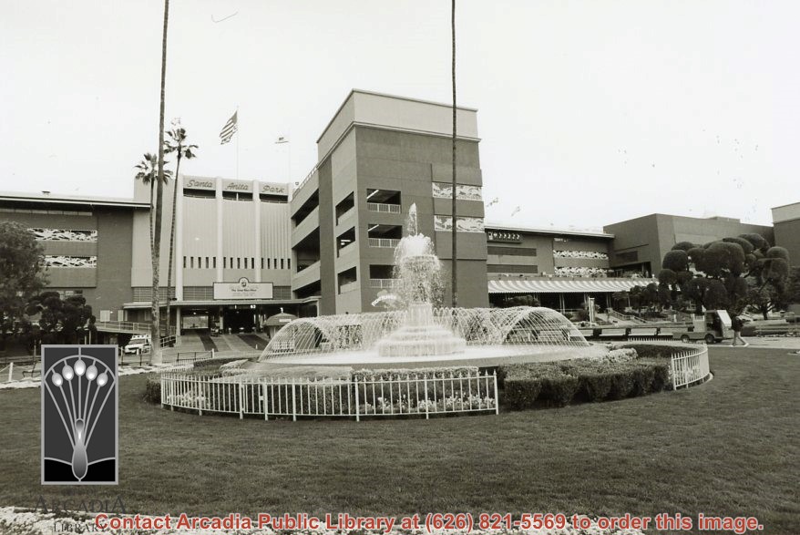
A view of Santa Anita Park entrance and fountain. Photo by Terry Miller.
https://arcadiahistory.andornot.com/en/permalink/photographs2365
- Date
- 2001
1 image
- Date
- 2001
- Subjects
- Santa Anita Park (2001-2010)
- Physical Description
- 4x6 b&w
- ID
- 2254B
- Collection
- Photographs
Images
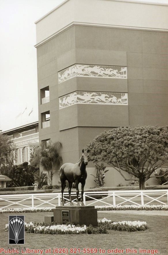
A view of Santa Anita Park buildings and sculpture of famous racehorse Seabiscuit. Photo by Terry Miller.
https://arcadiahistory.andornot.com/en/permalink/photographs2366
- Date
- 2001
1 image
- Date
- 2001
- Subjects
- Santa Anita Park (2001-2010)
- Physical Description
- 4x6 b&w
- ID
- 2254C
- Collection
- Photographs
Images
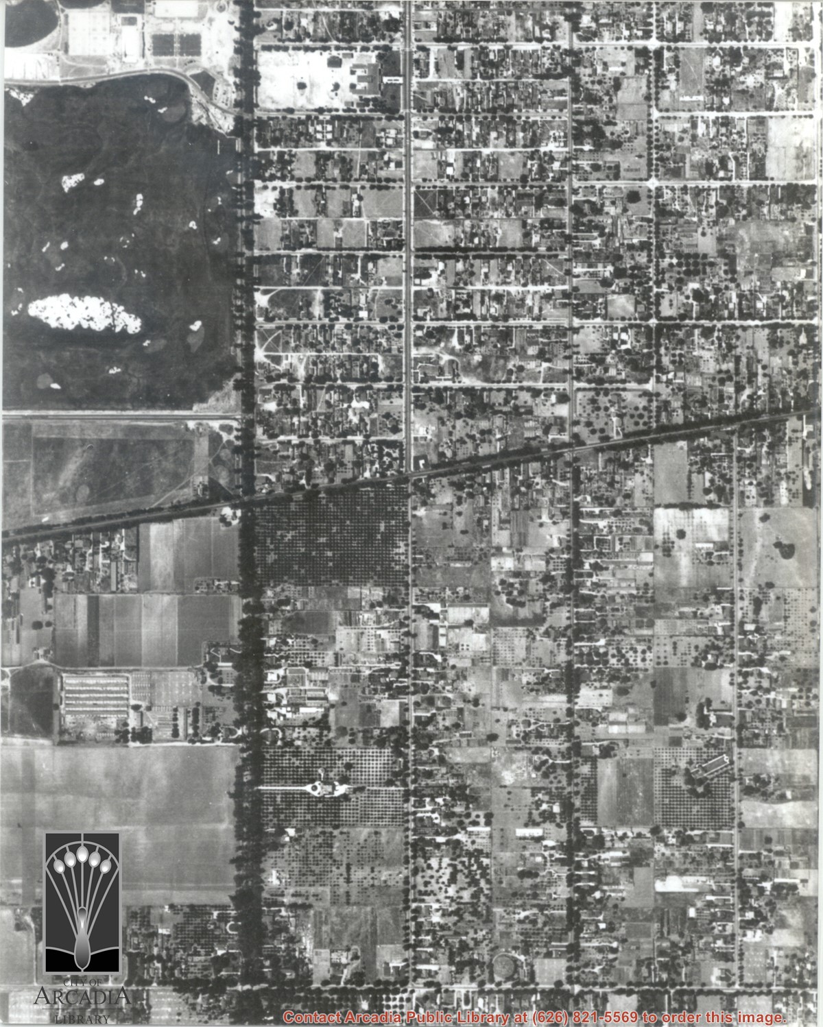
Santa Anita Park Race Track just right of center at south edge of photo. Oval to the left of Santa Anita Park Race Track was training track which was removed to make room for Santa Anita Fashion Park (currently Westfield Santa Anita Shopping Mall). Street just to left of training track is Baldwin Avenue. Huntington Drive and Colorado Place form a "y" just east of Santa Anita Park Race Track. Along both can be noticed the conifer trees planted a few years earlier. Street completely bisecting photo just below center is Foothill Boulevard, next one is Orange Grove Avenue. Santa Anita Avenue is partially in view on right edge of photo. Oval on extreme lower left side of photo is old Baldwin training track. Baseball diamond in lower right corner is at Arcadia County Park. Scale: 1"=660'
https://arcadiahistory.andornot.com/en/permalink/photographs620
- Date
- June 5, 1938
1 image
- Date
- June 5, 1938
- Subjects
- Aerial Photo Collection
- Aerial views
- Baldwin Avenue
- Colorado Boulevard
- Colorado Place
- Colorado Street
- Foothill Boulevard
- Huntington Drive
- Orange Grove Avenue
- Santa Anita Fashion Park (later known as Westfield Santa Anita)
- Santa Anita Park-1934-1942
- Physical Description
- 8x10 b&w
- ID
- 616
- Collection
- Photographs
Images


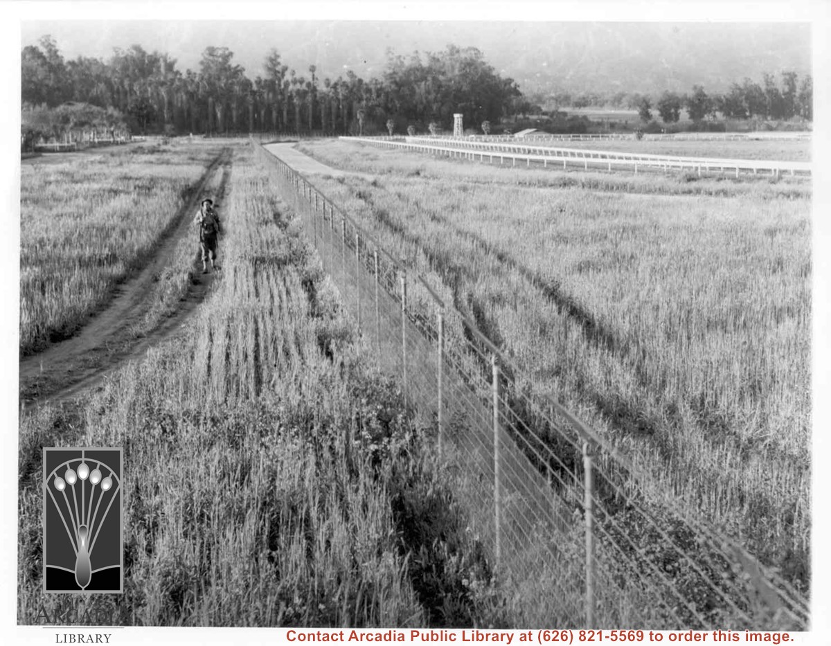
Lone army sentry patrolling outside fence of Santa Anita Assembly Center for the Japanese. White fencing encloses training track which was located alongside Baldwin Avenue, approximately where west parking area for Fashion Park (now Westfield Santa Anita mall) is now. Palm trees seen on left side, would be on grounds of present Arboretum.
https://arcadiahistory.andornot.com/en/permalink/photographs661
- Date
- April 1942
1 image
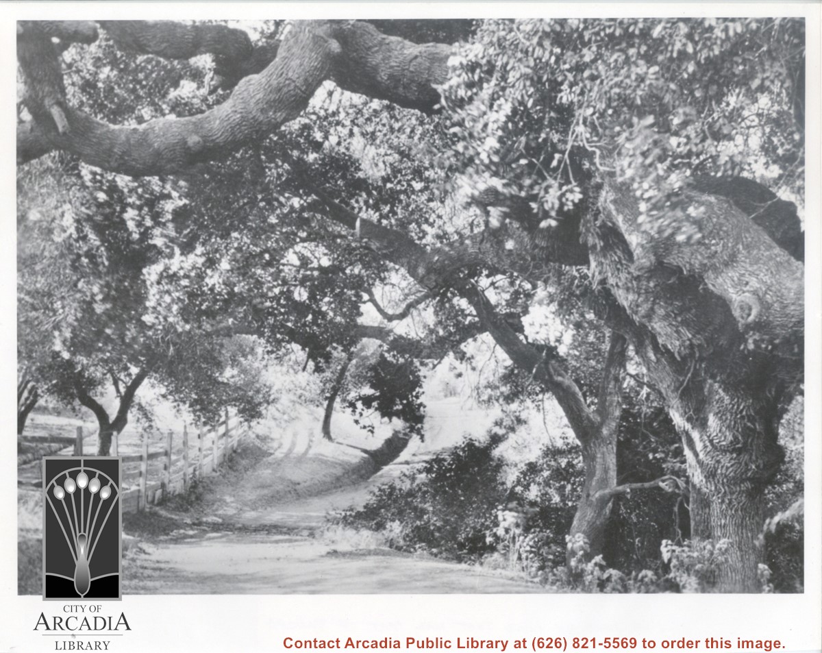
View of section of dirt road, beneath branches of large oak trees. There is wood fencing along left side of photo, believed to be taken on the Baldwin Ranch.
https://arcadiahistory.andornot.com/en/permalink/photographs119
- Date
- c.1900
1 image
- Date
- c.1900
- Subjects
- Rancho Santa Anita
- Baldwin Ranch
- Physical Description
- 8x10 b&w
- ID
- 119
- Collection
- Photographs
Images
Aerial view south on Colorado Street just over large turn to the west. The residential area known as Santa Anita Gardens shows along upper left section of photo. Note that the only commerical development along the north side of Colorado Street is the Westerner Motel just near intersection with Huntington Drive. Santa Fe Railroad tracks are seen in lower left corner of photo. Santa Anita Park Race Track is on right.
https://arcadiahistory.andornot.com/en/permalink/photographs641
- Date
- c. 1956
1 image
- Date
- c. 1956
- Subjects
- Aerial Photo Collection
- Aerial views
- Colorado Boulevard
- Colorado Street
- Huntington Drive
- Railroads
- Santa Anita Park-1945-1980
- Westerner Motel
- Physical Description
- 8x10 b&w
- ID
- 637
- Collection
- Photographs
Images
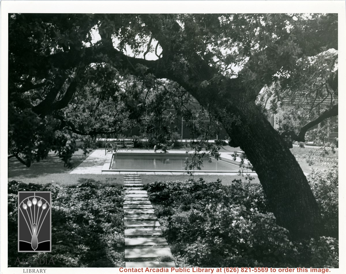
View of private swimming pool at a home in Santa Anita Oaks. A tennis court also appears in background. Address is not known. Oak tree in foreground and stepping stones leading to pool.
https://arcadiahistory.andornot.com/en/permalink/photographs280
- Date
- probably 1940's
1 image
- Date
- probably 1940's
- Subjects
- Houses
- Santa Anita Oaks
- Physical Description
- 8x10 b&w
- ID
- 278
- Collection
- Photographs
Images
Santa Anita Avenue running north and south on the left and Duarte Road intersects the middle. Enlargement of a section of photo ID 618.
https://arcadiahistory.andornot.com/en/permalink/photographs1449
- Date
- 1938
1 image
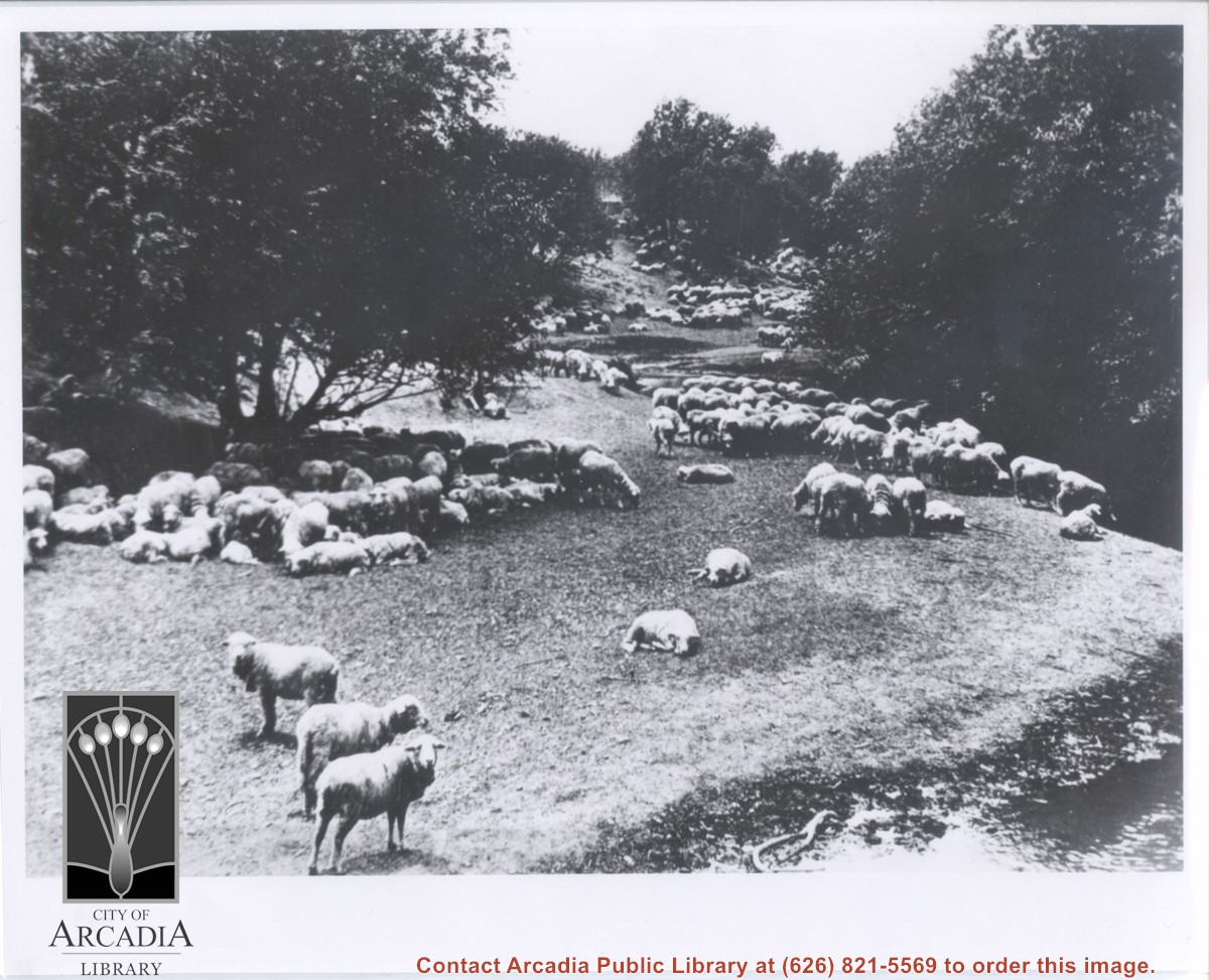
Sheep grazing beneath trees and apparently alongside a body of water (note extreme lower right section of photo). Believed to be on Rancho Santa Anita. Caption beneath one copy reads: "A pastoral scene on Santa Anita Rancho in 1890, just north of present Colorado Place."
https://arcadiahistory.andornot.com/en/permalink/photographs120
- Date
- 1890
1 image
- Date
- 1890
- Subjects
- Rancho Santa Anita
- Physical Description
- 8x10 b&w
- ID
- 120
- Collection
- Photographs
Images