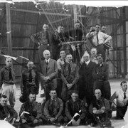
19 officers are in hangar at Ross Field in Arcadia as part of their training as Reserve Officers Balloon Personnel. J.H. Hoeppel in white shirt is on the right (kneeling). Lt.C.P. Kane, was in charge of the class. He is 4th man from left (next to balloon) in second row.
https://arcadiahistory.andornot.com/en/permalink/photographs1164
- Date
- 1927
1 image
- Date
- 1927
- Subjects
- Balloon School
- Hoeppel, John H.
- Kane, C.P.
- Physical Description
- 10x10 b&w badly cracked and broken
- ID
- 1155
- Collection
- Photographs
Images

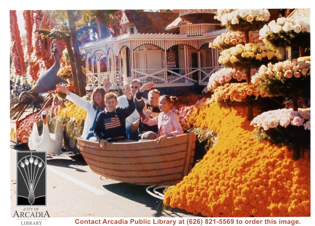
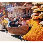
"100 Years of Good Health, Happiness, and Prosperity," Arcadia's float entry in the 2003 Pasadena Tournament of Roses Parade. Side view showing five of the riders in a small boat, Queen Anne Cottage, peacock, and goose. Riders left to right: Dawn Pejsar, Nicholas Campbell, Dr. Bradford Hack, Lane Barcham, Alison Chien.
https://arcadiahistory.andornot.com/en/permalink/photographs1713
- Date
- January 1, 2003
1 image
- Date
- January 1, 2003
- Subjects
- Tournament of Roses - Floats - 2003
- Centennial Celebrations, 2003
- Bracham, Lane
- Campbell, Nicholas
- Chien, Alison
- Hack, Bradford (Dr.)
- Pejsar, Dawn
- Physical Description
- 5x7 color
- ID
- 1701
- Collection
- Photographs
Images
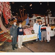
"100 Years of Good Health, Happiness, and Prosperity," Arcadia's float entry in the 2003 Pasadena Tournament of Roses Parade. Side view showing the Queen Anne Cottage and peacock. Riders standing on ground, left to right: Black Hawk pilot, Captain Jon Shafer representing local service men and women; Nicholas Campbell, Dr. Bradford Hack, and Dawn Pejsar representing Methodist Hospital; Lane Barcham and Alison Chien representing local children.
https://arcadiahistory.andornot.com/en/permalink/photographs1712
- Date
- January 1, 2003
1 image
- Date
- January 1, 2003
- Subjects
- Tournament of Roses - Floats - 2003
- Centennial Celebrations, 2003
- Barcham, Lane
- Campbell, Nicholas
- Chien, Alison
- Hack, Bradford (Dr.)
- Pejsar, Dawn
- Shafer, Jon (Capt.)
- Physical Description
- 5x7 color
- ID
- 1700
- Collection
- Photographs
Images

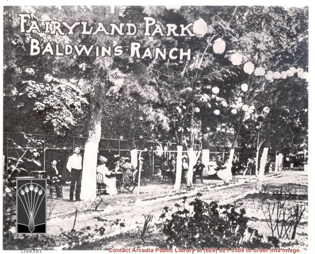
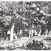
About 18 people are seen seated outdoors at tables under trees decorated with Japanese paper lanterns. A waiter stands by closest tree. Printed on photo are words: FAIRYLAND PARK BALDWIN'S RANCH.
https://arcadiahistory.andornot.com/en/permalink/photographs934
- Date
- c.1905
1 image
- Date
- c.1905
- Subjects
- Oakwood Hotel
- Fairyland Park
- Physical Description
- 8x10 b&w
- ID
- 927
- Collection
- Photographs
Images
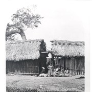
Adjoining reed houses with sloping thatch-type roofs are shown with a group of Indians sitting by them. One small Indian girl is standing by group with her hands on her hips. This photograph belongs to the Huntington Library. It is shown here for research only.
https://arcadiahistory.andornot.com/en/permalink/photographs732
- Date
- c.1878-9
1 image
- Date
- c.1878-9
- Subjects
- Rancho Santa Anita-1875-1909
- Physical Description
- 8x10 b&w
- ID
- 728
- Collection
- Photographs
Images

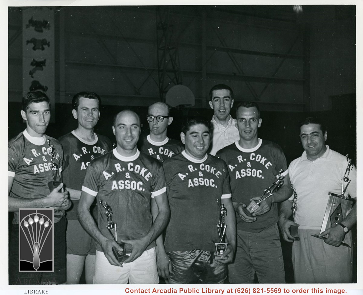
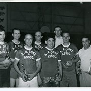
Adult "Champions" Recreation basketball league holding trophies. From left to right: Barry Eichorn, Jim Key, Tony Stillson, Ron Manwarren, Dick Noriega, Les Christensen, Bill Frantz, Al Coke-Manager. Their shirts read: A.R. Coke & Assoc. Al Coke was first president of Arcadia Little League.
https://arcadiahistory.andornot.com/en/permalink/photographs1947
- Date
- 1964
1 image
- Date
- 1964
- Subjects
- Recreation Department Collection
- Awards
- Basketball
- Christensen, Les
- Coke, Al
- Eichorn, Barry
- Frantz, Bill
- Key, Jim
- Manwarren, Ron
- Noriega, Dick
- Stillson, Tony
- Physical Description
- 8x10 b&w
- ID
- 1928
- Collection
- Photographs
Images
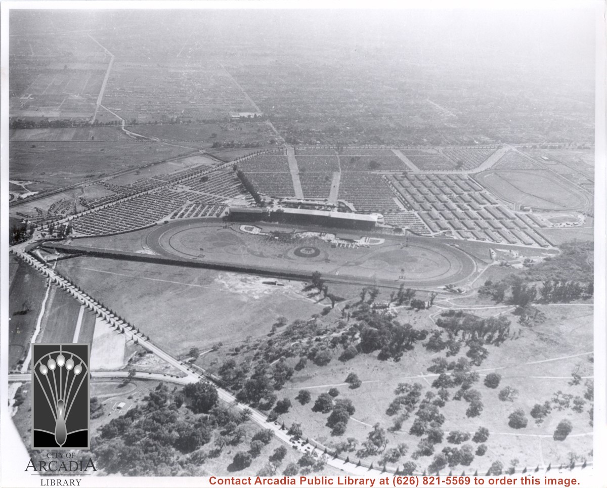
Aerial view due south from a position almost directly over sharp curve of Colorado Street. Showing in this photo are the Track and Club House on a day of large attendance, the stables, and a training track. All along Huntington Drive and Colorado Street young trees have been planted. Old-time resident Reid Greer says that the large tree at the very left edge of photo about 2 1/2 in. from bottom is same tree as seen in photo #654, on flat ground just below knolls seen here, and therefore he places homes of Indians on ranch at this spot. E.J."Lucky" Baldwin winery is only building seen on knoll. There is an "x" on reverse side to mark location. This photo belongs to the Huntington Library. It is shown here for research only.
https://arcadiahistory.andornot.com/en/permalink/photographs632
- Date
- c. 1935
1 image
- Date
- c. 1935
- Subjects
- Baldwin, Elias J. "Lucky"-Wines and winemaking
- Colorado Blvd
- Colorado Street
- Huntington Drive
- Santa Anita Park-1934-1942
- Physical Description
- 8x10 b&w
- ID
- 628
- Collection
- Photographs
Images
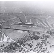
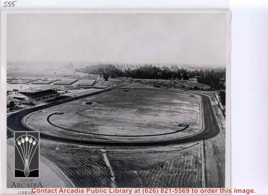
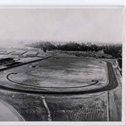
Aerial view from east looking west over Santa Anita Race Track shortly after its opening. Baldwin Avenue shows just faintly as a white line above track barns. Note total absence of homes in what we call Santa Anita Village and Lower Rancho.
https://arcadiahistory.andornot.com/en/permalink/photographs559
- Date
- c. December 1934
1 image
- Date
- c. December 1934
- Subjects
- Santa Anita Park-1934-1942
- Physical Description
- 8x10 b&w
- ID
- 555
- Collection
- Photographs
Images
Aerial view from position above Huntington Drive near Holly Avenue intersection looking north over Santa Anita Park. Colorado Place and Huntington Drive are seen coming together at right side of photo. Note how small the deodar (?) trees planted along Huntington Drive and Colorado Place are. Row of trees seen in center of photo were apparently left from Ranch days and were later removed.
https://arcadiahistory.andornot.com/en/permalink/photographs984
- Date
- December 1, 1935
1 image
- Date
- December 1, 1935
- Subjects
- Aerial Photo Collection
- Aerial views
- Colorado Place
- Huntington Drive
- Santa Anita Park-1934-1942
- Physical Description
- 8x10 b&w
- ID
- 976
- Collection
- Photographs
Images

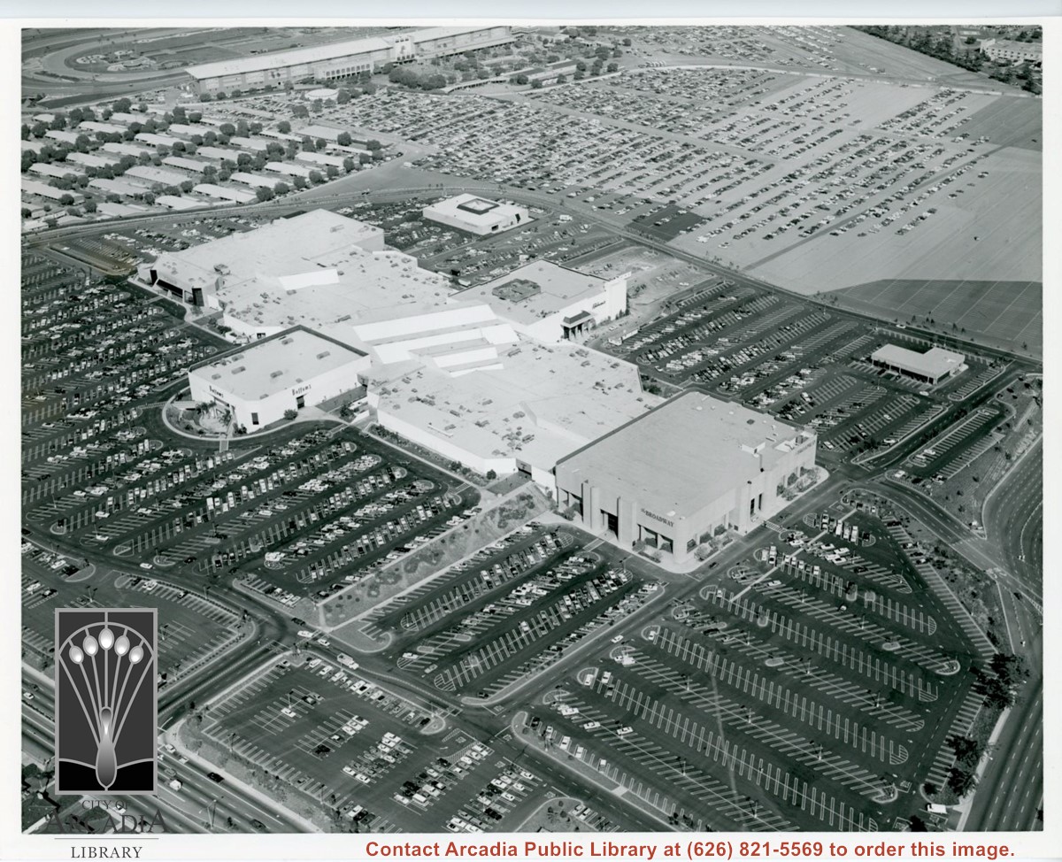
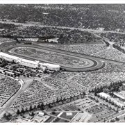
Aerial view looking down on Fashion Park from a position over intersection of Baldwin & Huntington Drive. Looking N toward Santa Anita Race Track grandstand during racing season (all of the cars parked on light-surfaced parking area are attending races.)
https://arcadiahistory.andornot.com/en/permalink/photographs736
- Date
- c.1975
1 image
Aerial view looking east across Santa Anita Park taken from a position just west of Baldwin Avenue, which is seen at bottom of photo. Huntington Drive appears exactly in center of photo just east of race track. The 210 Foothill Freeway enters area in upper right portion of picture and exits at left side in upper left portion.
https://arcadiahistory.andornot.com/en/permalink/photographs996
- Date
- c.1979
1 image
- Date
- c.1979
- Subjects
- Aerial Photo Collection
- Aerial views
- 210 Foothill Freeway
- Huntington Drive
- Santa Anita Park-1945-1980
- Physical Description
- 8x10 b&w
- ID
- 989
- Collection
- Photographs
Images


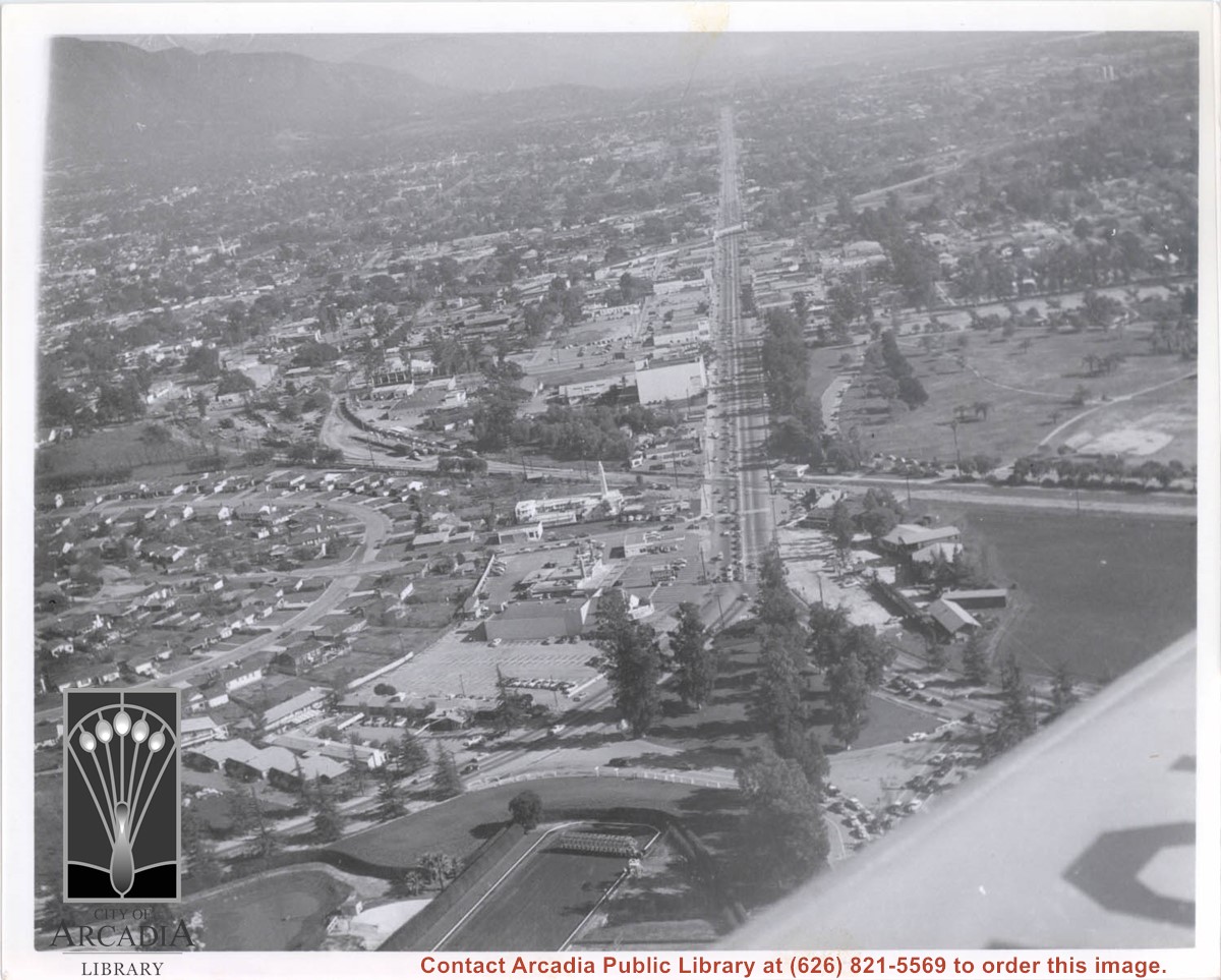
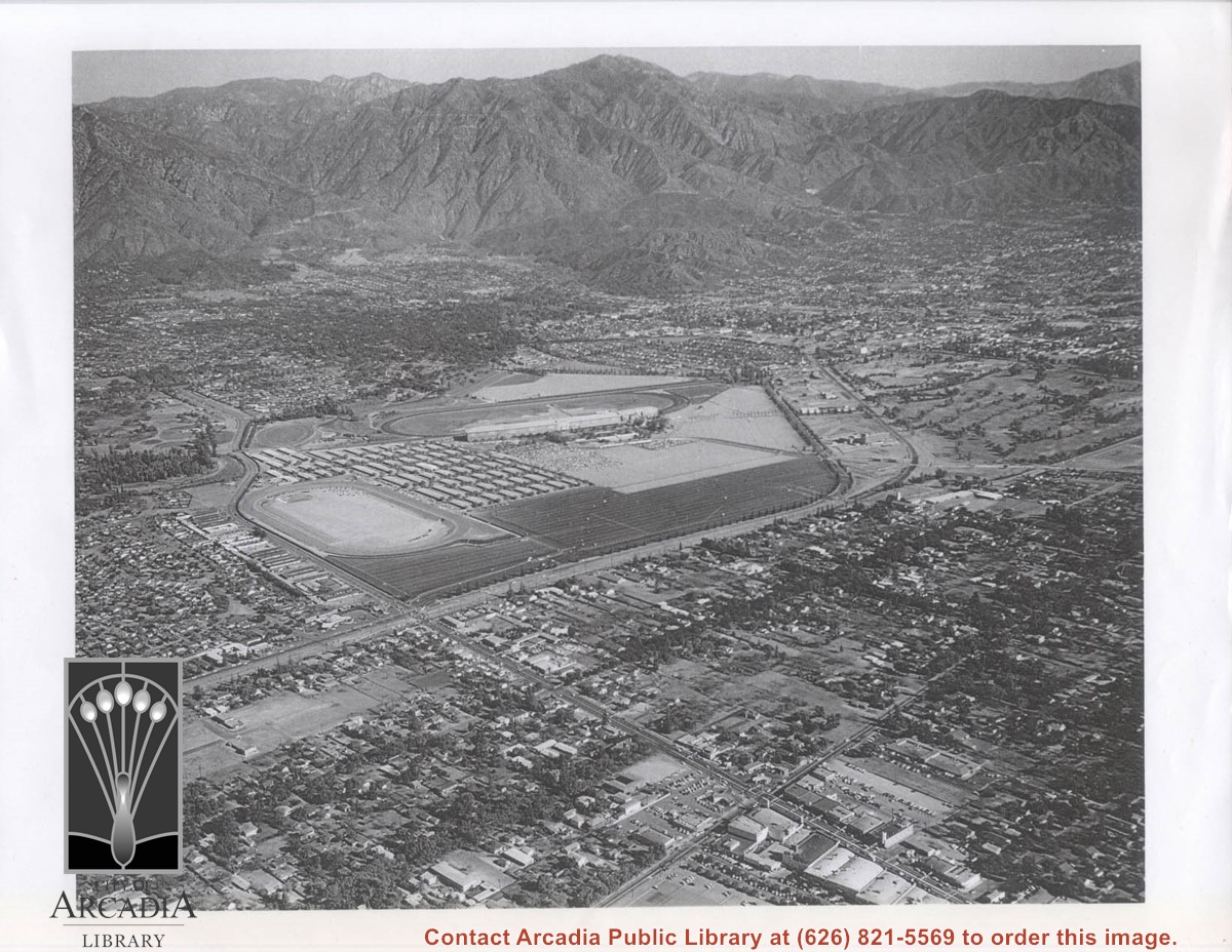
Aerial view looking east along Huntington Drive taken over the Club House at Santa Anita Park Race Track. Pony Express Museum is just to right of the "y" intersection of Huntington Drive coming into Arcadia just below the wing of the plane. Theater that was opened in 1942 is almost directly opposite Museum. Santa Anita Motor Inn, two buildings east of theater, distinguished by tall tower, opened in 1938. (It was torn down in 1975.) The residential area directly north of there is known as Santa Anita Gardens. Santa Anita Avenue is just beyond Arcadia County Park on right.
https://arcadiahistory.andornot.com/en/permalink/photographs642
- Date
- c. 1957-58
1 image
- Date
- c. 1957-58
- Subjects
- Aerial Photo Collection
- Aerial views
- Huntington Drive
- Pony Express Museum
- Santa Anita Avenue
- Santa Anita Motor Inn
- Physical Description
- 8x10 b&w
- ID
- 638
- Collection
- Photographs
Images
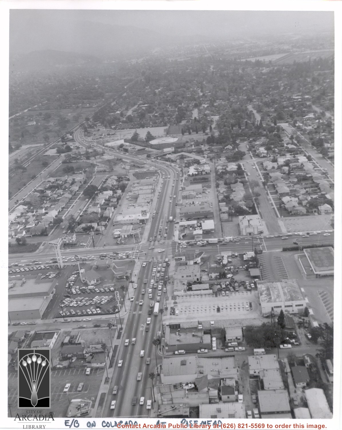
Aerial view looking east into Arcadia from near intersection of Rosemead Boulevard and Colorado Boulevard. Eaton's Santa Anita Hotel and Restaurant is still seen at far end of curve on south side of Colorado Boulevard and Michillinda Avenue (this is present site of Coco's Restaurant and Oak Tree Banquet Room, formerly Reuben's Restaurant, address 1150 W. Colorado Boulevard). The Santa Fe Railroad Tracks are seen just north of Colorado Boulevard. Large clear area in upper right portion of photo is Santa Anita Park Race Track.
https://arcadiahistory.andornot.com/en/permalink/photographs638
- Date
- c.1970
1 image
- Date
- c.1970
- Subjects
- Aerial Photo Collection
- Aerial views
- Colorado Boulevard
- Colorado Street
- Eaton's Santa Anita Hotel and Restaurant (1939-1969)
- Michillinda Avenue
- Railroads
- Santa Anita Park-1945-1980
- Physical Description
- 8x10 b&w
- ID
- 634
- Collection
- Photographs
Images
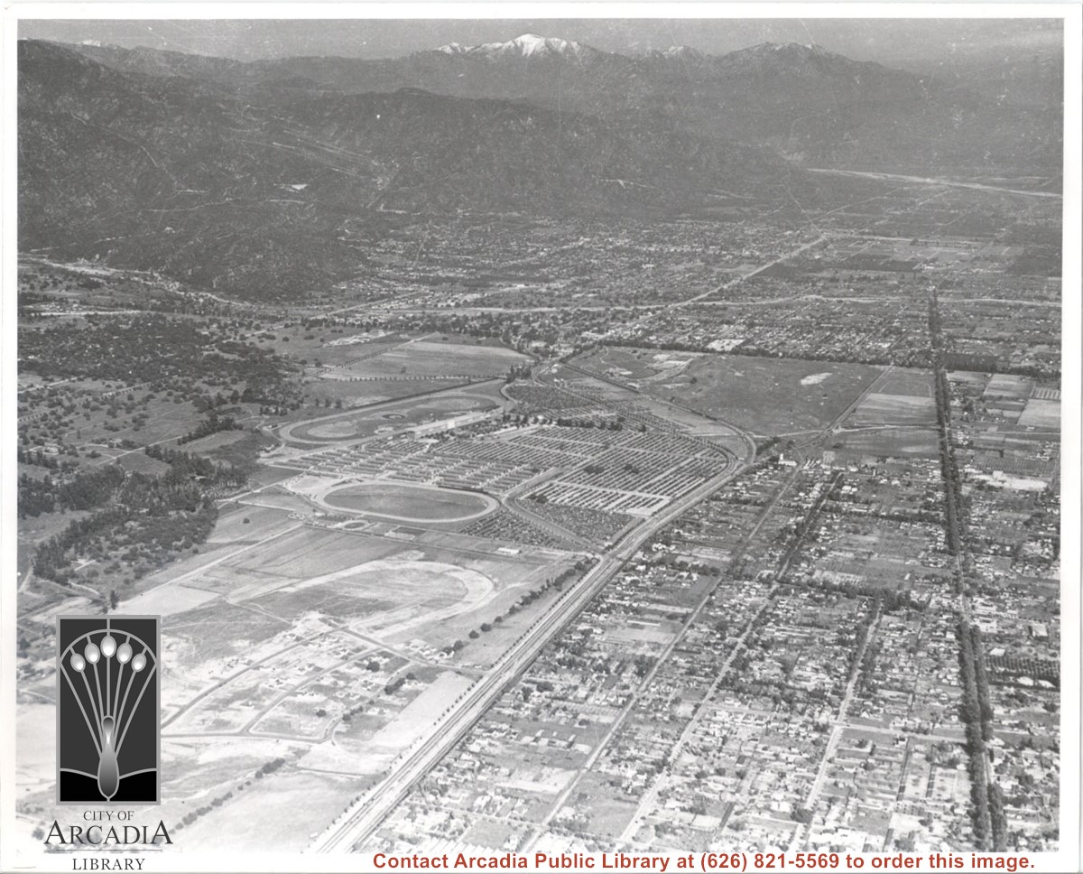
Aerial view. Looking east. Street along right edge of photo which is lined with trees is Duarte Road. Santa Anita Avenue cuts across photo from right to left and up into the San Gabriel Mountains. Huntington Drive can be seen in center of photo with young trees planted on north side of it. Santa Anita Race Track is one furthest from camera. The next small track is a training track belonging to Santa Anita. There is a VERY small round track across the street from the training track, which was part of a private horse stables. The incompleted oval was part of work done in 1933 by Joe Smoot and Anita Baldwin in their effort to develop the Jockey Club Track. This photo belongs to the Huntington Library. It is shown here for research only.
https://arcadiahistory.andornot.com/en/permalink/photographs627
- Date
- c. 1935
1 image
- Date
- c. 1935
- Subjects
- Duarte Road
- Huntington Drive
- Los Angeles Jockey Club
- San Gabriel Mountains
- Santa Anita Park-1934-1942
- Physical Description
- 8x10 b&w
- ID
- 623
- Collection
- Photographs
Images
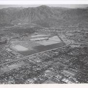
Aerial view looking north across Santa Anita Park from a position over Arcadia County Park. Large infield crowd is evident and all parking areas are filled. Arcadia Methodist Hospital shows in lower left part of photo and Arcadia Police facility is seen in lower right. The 210 Foothill Freeway cuts across photo near the top.
https://arcadiahistory.andornot.com/en/permalink/photographs995
- Date
- c.1979
1 image
- Date
- c.1979
- Subjects
- Aerial Photo Collection
- Aerial views
- 210 Foothill Freeway
- Arcadia Methodist Hospital
- Santa Anita Park-1945-1980
- Physical Description
- 8x10 b&w
- ID
- 988
- Collection
- Photographs
Images

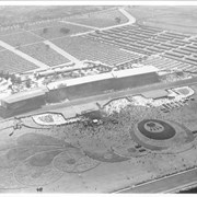
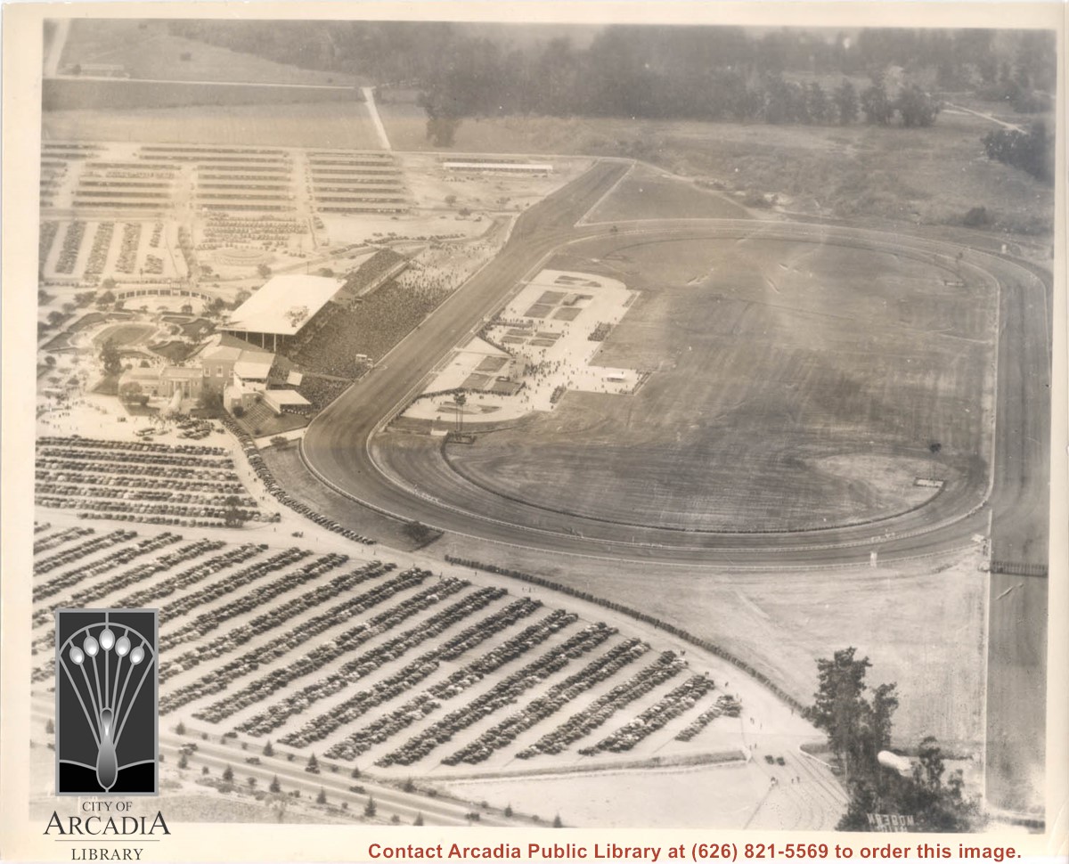
Aerial view looking south over Santa Anita Race Track on a day of very heavy attendance. The floral plantings which form designs in the in-field are shown clearly. Also seen are: the clubhouse, the stables, and the training track. These latter were either moved or done away with to make way for the Fashion Park. Main gate was at NE corner of Huntington Drive and Baldwin, which was not cut through at that time. This photo belongs to the Huntington Library. It is shown here for research only.
https://arcadiahistory.andornot.com/en/permalink/photographs631
- Date
- c. 1935
1 image

Aerial view looking towards San Gabriel Mountains showing intersection of Baldwin Avenue and Huntington Drive, the Santa Anita Park and training track where Santa Anita Fashion Park (currently known as Westfield Santa Anita Shopping Mall) was built.
https://arcadiahistory.andornot.com/en/permalink/photographs1754
- Date
- Unknown
1 image
- Date
- Unknown
- Subjects
- Aerial Photo Collection
- Aerial views
- Baldwin Avenue
- Huntington Drive
- Malls
- San Gabriel Mountains
- Santa Anita Fashion Park
- Santa Anita Park, 1945-1980
- Westfield Santa Anita Shopping Mall
- Physical Description
- 8x10 b&w photocopy
- ID
- 1742
- Collection
- Photographs
Images
Aerial view looking west across Santa Anita Park from a position about Santa Anita Avenue just north of Huntington Drive. In the upper right portion of the photo can be seen the extensive earthwork done for the track Anita Baldwin and Joe Smoot planned to build. That vast area now is entirely built with homes and apartments and is called Santa Anita Village. Present-day Baldwin Avenue would follow the line shown by the Ranch Road bisecting the photo from right to left just east of the track abandoned by Anita Baldwin and Joe Smoot.
https://arcadiahistory.andornot.com/en/permalink/photographs985
- Date
- c.1934
1 image
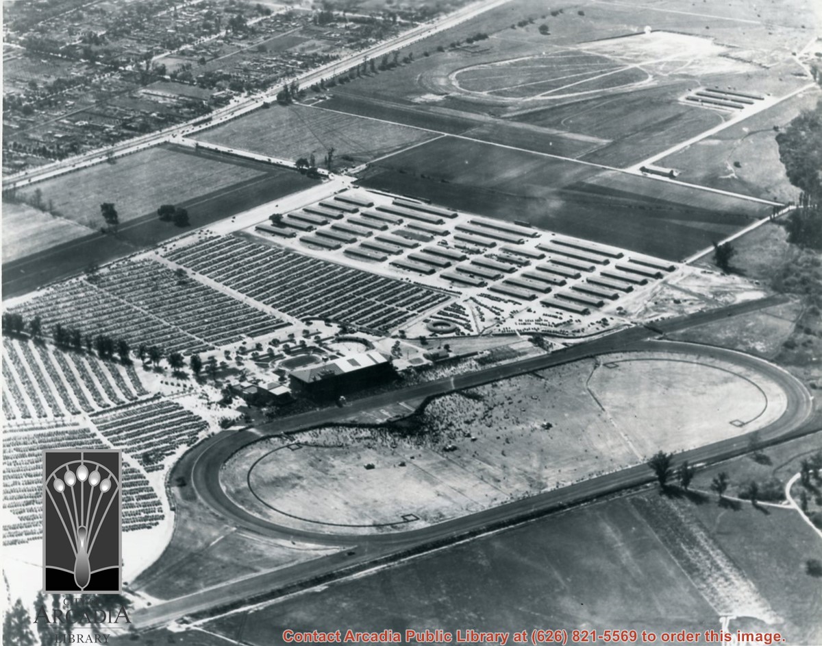
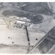
Aerial view looking west over Santa Anita Park. Photo was taken from about over intersection of Colorado Place and Huntington Drive. Note area that was to become Los Angeles County Arboretum across top of photo. Note an open Grandstand has been added to the west of original covered one. There is a small dirigible in lower right corner carrying a sign that seems to read:modern motel. Present Baldwin Avenue would run where road in this photo is seen parallel to top of photo.
https://arcadiahistory.andornot.com/en/permalink/photographs983
- Date
- December 28, 1935
1 image
- Date
- December 28, 1935
- Physical Description
- 8x10 b&w
- ID
- 975
- Collection
- Photographs
Images
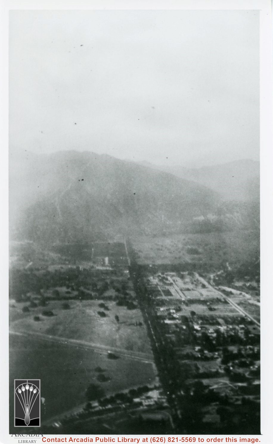
Aerial view north up Santa Anita Avenue. Note Chantry Flats Road on mountain near right side of photo. This view was taken from just south of Huntington Drive. This image belongs to Arcadia Historical Society.
https://arcadiahistory.andornot.com/en/permalink/photographs587
- Date
- November 1926
1 image
- Date
- November 1926
- Physical Description
- 6x10 vertical
- ID
- 583
- Collection
- Photographs
Images