Neatly white washed trunks of trees alongside a wall, with row of trees opposite is seen in this photo. Caption beneath reads: First Street Entrance To Fairyland Park, Baldwin's Ranch. This photo is an enlarged view of Photo #1353.
https://arcadiahistory.andornot.com/en/permalink/photographs930
- Date
- 1907
1 image
- Date
- 1907
- Subjects
- Fairyland Park
- Physical Description
- 8x10 b&w
- ID
- 923
- Collection
- Photographs
Images
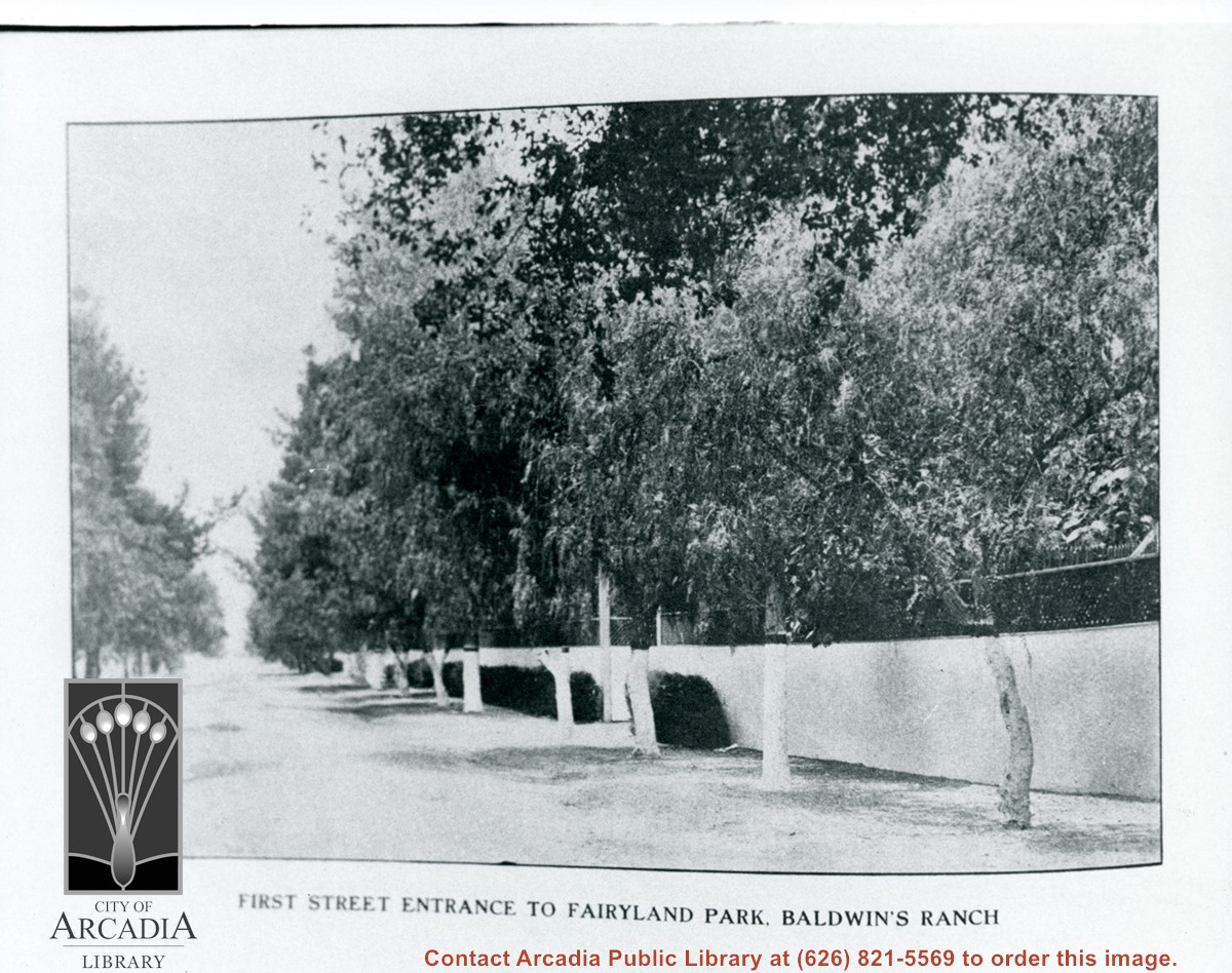
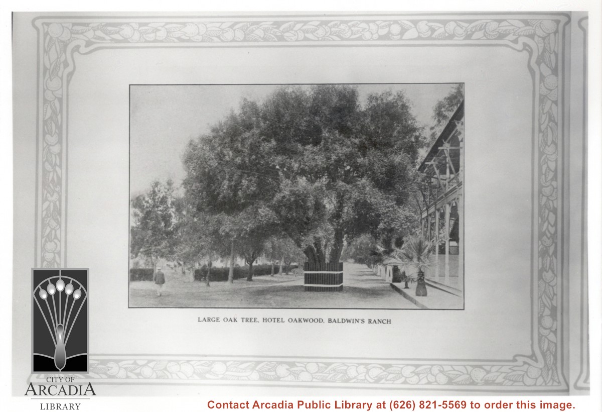
Photo of a page from the 1907 Los Angeles Racing Association Souvenir Booklet showing "Large oak tree, Hotel Oakwood, Baldwin's Ranch." The Oakwood Hotel is just visible to the right of the photo. The large oak tree dominates the center of the photo.
https://arcadiahistory.andornot.com/en/permalink/photographs1361
- Date
- 1907 season
1 image
- Date
- 1907 season
- Subjects
- Oakwood Hotel
- Physical Description
- 8x10 b&w
- ID
- 1352
- Collection
- Photographs
Images
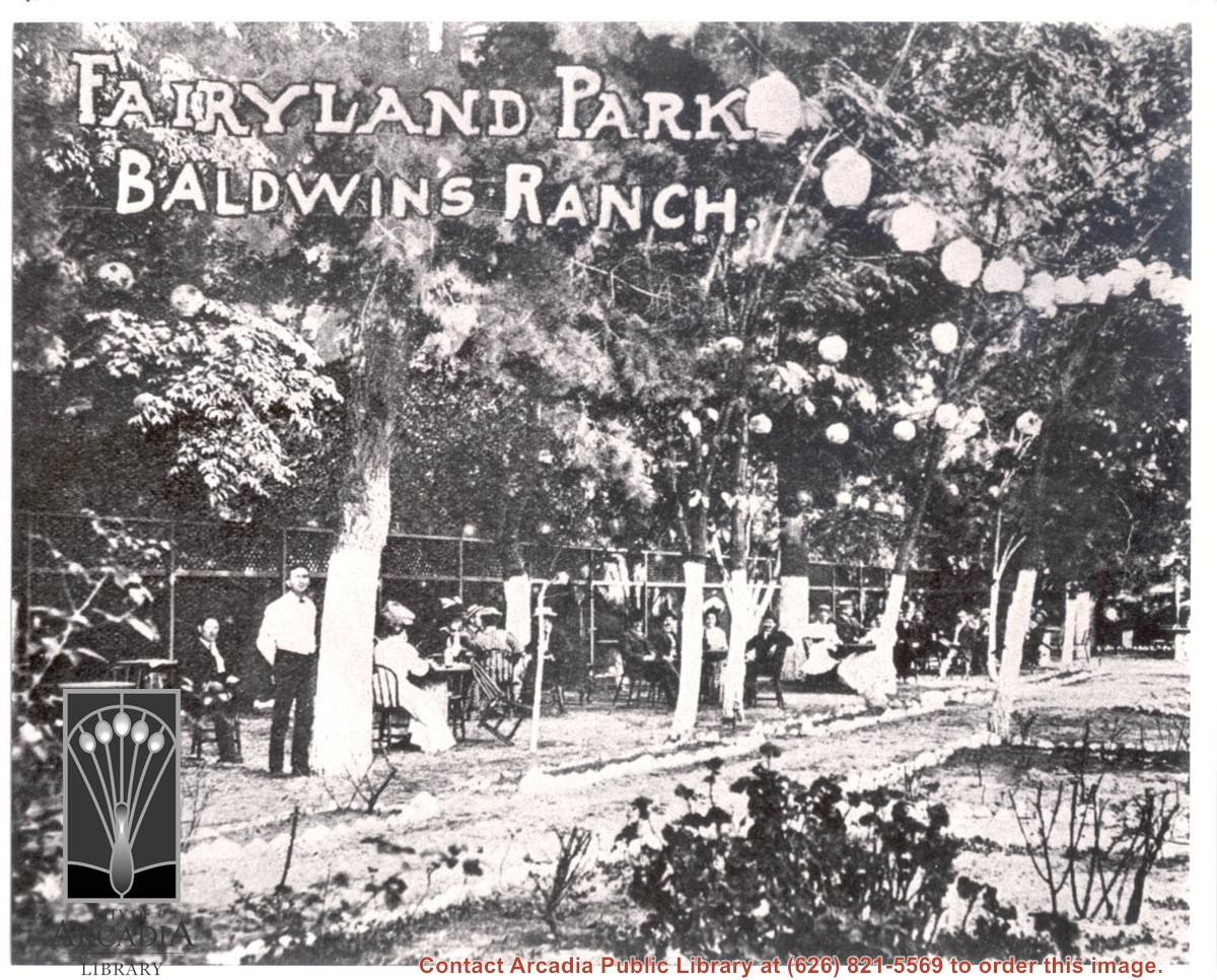
About 18 people are seen seated outdoors at tables under trees decorated with Japanese paper lanterns. A waiter stands by closest tree. Printed on photo are words: FAIRYLAND PARK BALDWIN'S RANCH.
https://arcadiahistory.andornot.com/en/permalink/photographs934
- Date
- c.1905
1 image
- Date
- c.1905
- Subjects
- Oakwood Hotel
- Fairyland Park
- Physical Description
- 8x10 b&w
- ID
- 927
- Collection
- Photographs
Images
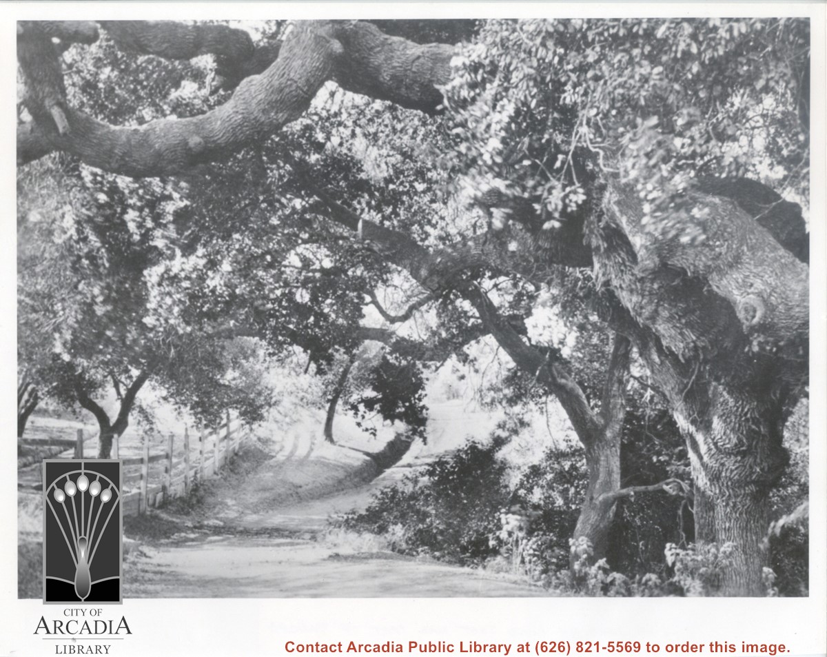
View of section of dirt road, beneath branches of large oak trees. There is wood fencing along left side of photo, believed to be taken on the Baldwin Ranch.
https://arcadiahistory.andornot.com/en/permalink/photographs119
- Date
- c.1900
1 image
- Date
- c.1900
- Subjects
- Rancho Santa Anita
- Baldwin Ranch
- Physical Description
- 8x10 b&w
- ID
- 119
- Collection
- Photographs
Images
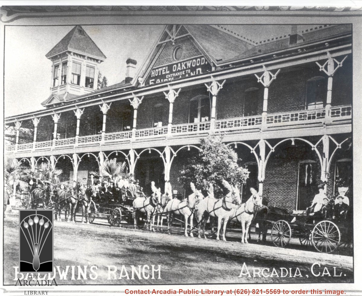
One carriage and two tally hos are stopped in front of Oakwood Hotel. About 18 people are seated in the conveyances. White horses hitched to middle tally ho, have white plumes fixed to their harness. Sign above reads: Hotel Oakwood - Entrance to Fairyland. On the bottom of photo is printed: Baldwin's Ranch, Arcadia, Cal.
https://arcadiahistory.andornot.com/en/permalink/photographs935
- Date
- c.1905
1 image
- Date
- c.1905
- Subjects
- Oakwood Hotel
- Fairyland Park
- Physical Description
- 8x10 b&w
- ID
- 928
- Collection
- Photographs
Images
Aerial view south on Colorado Street just over large turn to the west. The residential area known as Santa Anita Gardens shows along upper left section of photo. Note that the only commerical development along the north side of Colorado Street is the Westerner Motel just near intersection with Huntington Drive. Santa Fe Railroad tracks are seen in lower left corner of photo. Santa Anita Park Race Track is on right.
https://arcadiahistory.andornot.com/en/permalink/photographs641
- Date
- c. 1956
1 image
- Date
- c. 1956
- Subjects
- Aerial Photo Collection
- Aerial views
- Colorado Boulevard
- Colorado Street
- Huntington Drive
- Railroads
- Santa Anita Park-1945-1980
- Westerner Motel
- Physical Description
- 8x10 b&w
- ID
- 637
- Collection
- Photographs
Images
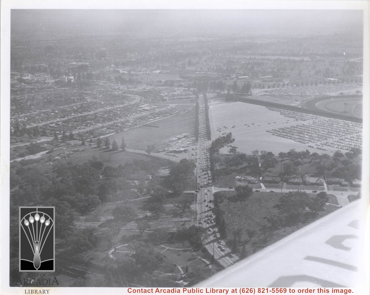
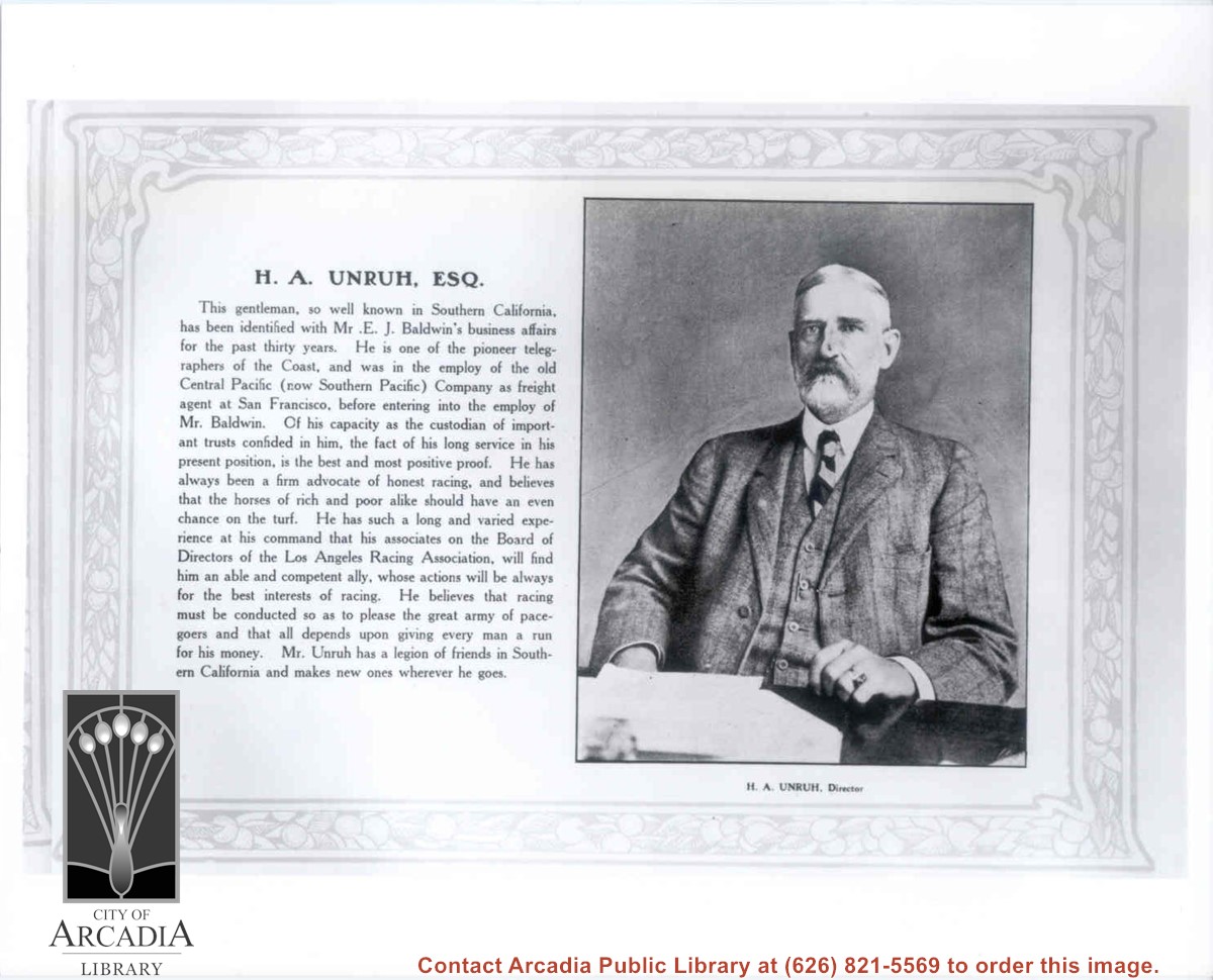
Photo from a page of the 1907 Los Angeles Racing Association Souvenir Booklet showing a portrait of H.A. Unruh and a short biography. Mr. Unruh is wearing a three-piece suit and tie and is seated behind a desk.
https://arcadiahistory.andornot.com/en/permalink/photographs1363
- Date
- 1907 season
1 image
- Date
- 1907 season
- Subjects
- Unruh, Hiram Augustus
- Physical Description
- 8x10 b&w
- ID
- 1354
- Collection
- Photographs
Images
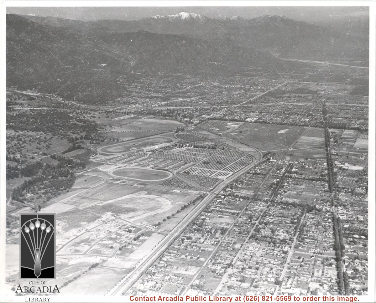
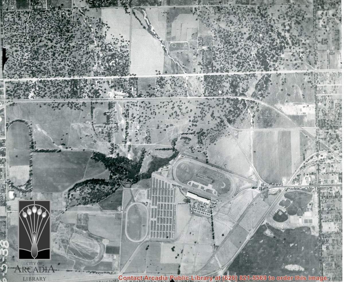
Santa Anita Park Race Track just right of center at south edge of photo. Oval to the left of Santa Anita Park Race Track was training track which was removed to make room for Santa Anita Fashion Park (currently Westfield Santa Anita Shopping Mall). Street just to left of training track is Baldwin Avenue. Huntington Drive and Colorado Place form a "y" just east of Santa Anita Park Race Track. Along both can be noticed the conifer trees planted a few years earlier. Street completely bisecting photo just below center is Foothill Boulevard, next one is Orange Grove Avenue. Santa Anita Avenue is partially in view on right edge of photo. Oval on extreme lower left side of photo is old Baldwin training track. Baseball diamond in lower right corner is at Arcadia County Park. Scale: 1"=660'
https://arcadiahistory.andornot.com/en/permalink/photographs620
- Date
- June 5, 1938
1 image
- Date
- June 5, 1938
- Subjects
- Aerial Photo Collection
- Aerial views
- Baldwin Avenue
- Colorado Boulevard
- Colorado Place
- Colorado Street
- Foothill Boulevard
- Huntington Drive
- Orange Grove Avenue
- Santa Anita Fashion Park (later known as Westfield Santa Anita)
- Santa Anita Park-1934-1942
- Physical Description
- 8x10 b&w
- ID
- 616
- Collection
- Photographs
Images


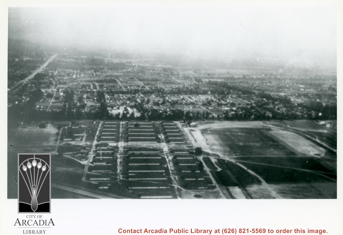
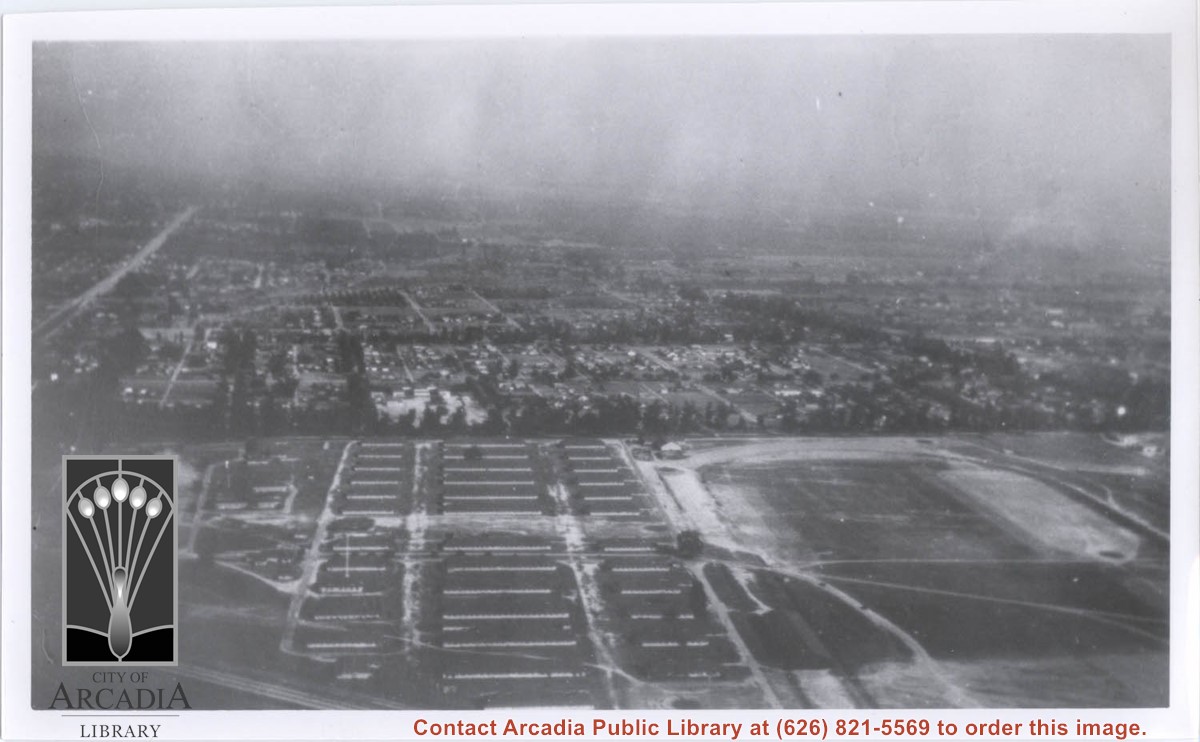
Looking east over barracks and main building at Ross Field. Tree-lined street cutting across photo at far side of field is Santa Anita Avenue. The oval of the race track built by E.J."Lucky" Baldwin and which opened in 1907 can clearly be seen on right. Broad E/W street seen on far left is Huntington Drive.
https://arcadiahistory.andornot.com/en/permalink/photographs867
- Date
- c.1928
1 image
Aerial view from position above Huntington Drive near Holly Avenue intersection looking north over Santa Anita Park. Colorado Place and Huntington Drive are seen coming together at right side of photo. Note how small the deodar (?) trees planted along Huntington Drive and Colorado Place are. Row of trees seen in center of photo were apparently left from Ranch days and were later removed.
https://arcadiahistory.andornot.com/en/permalink/photographs984
- Date
- December 1, 1935
1 image
- Date
- December 1, 1935
- Subjects
- Aerial Photo Collection
- Aerial views
- Colorado Place
- Huntington Drive
- Santa Anita Park-1934-1942
- Physical Description
- 8x10 b&w
- ID
- 976
- Collection
- Photographs
Images

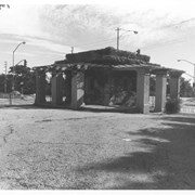
View of gatehouse, looking toward southeast. Visible thru gate on left side of photo is Baldwin Avenue and on right side of photo, Foothill Boulevard.
https://arcadiahistory.andornot.com/en/permalink/photographs18
- Date
- November 1976
1 image
- Date
- November 1976
- Subjects
- Anoakia
- Physical Description
- 8x10 b&w
- ID
- 18
- Collection
- Photographs
Images

Aerial view. Looking east. Street along right edge of photo which is lined with trees is Duarte Road. Santa Anita Avenue cuts across photo from right to left and up into the San Gabriel Mountains. Huntington Drive can be seen in center of photo with young trees planted on north side of it. Santa Anita Race Track is one furthest from camera. The next small track is a training track belonging to Santa Anita. There is a VERY small round track across the street from the training track, which was part of a private horse stables. The incompleted oval was part of work done in 1933 by Joe Smoot and Anita Baldwin in their effort to develop the Jockey Club Track. This photo belongs to the Huntington Library. It is shown here for research only.
https://arcadiahistory.andornot.com/en/permalink/photographs627
- Date
- c. 1935
1 image
- Date
- c. 1935
- Subjects
- Duarte Road
- Huntington Drive
- Los Angeles Jockey Club
- San Gabriel Mountains
- Santa Anita Park-1934-1942
- Physical Description
- 8x10 b&w
- ID
- 623
- Collection
- Photographs
Images
Michillinda Avenue is street running parallel to left edge of photo. Santa Anita Avenue is close to right edge of photo. Four tracks are in view. Left to right they would be: 1. Training track used by Elias J. "Lucky" Baldwin, 2. Aborted L. A. Jockey Club Track project of Anita Baldwin and Joe Smoot in 1933, 3. Small training track belonging to Santa Anita Park Race Track, and 4. Main track and grandstand of Santa Anita Park. Arcadia County Park is seen in lower right portion of photo.
https://arcadiahistory.andornot.com/en/permalink/photographs626
- Date
- June 5, 1938
1 image
- Date
- June 5, 1938
- Subjects
- Aerial Photo Collection
- Aerial views
- Los Angeles Jockey Club
- Michillinda Avenue
- Race tracks
- Santa Anita Park-1934-1942
- Physical Description
- 8x10 b&w
- ID
- 622
- Collection
- Photographs
Images
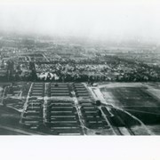
Aerial view toward the east taken from about over present Club House at Santa Anita Park Race Track. The main street running North/South is Santa Anita Avenue. View shows the oval of Elias J. "Lucky" Baldwin's race track in what is currently Arcadia County Park. The buildings would be barracks of Ross Field U.S. Army Balloon School. Duarte Road can be seen coming into photo at right edge of photo near intersection with Santa Anita Avenue. The broad street along left side would be Huntington Drive. Railroad tracks can be seen in lower left corner.
https://arcadiahistory.andornot.com/en/permalink/photographs635
- Date
- November 1929
1 image
- Date
- November 1929
- Subjects
- Aerial Photo Collection
- Aerial views
- Balloon School
- Huntington Drive
- Race tracks
- Railroads
- Santa Anita Avenue
- Physical Description
- 6x10 b&w
- ID
- 631
- Collection
- Photographs
Images

Aerial view looking east across Santa Anita Park taken from a position just west of Baldwin Avenue, which is seen at bottom of photo. Huntington Drive appears exactly in center of photo just east of race track. The 210 Foothill Freeway enters area in upper right portion of picture and exits at left side in upper left portion.
https://arcadiahistory.andornot.com/en/permalink/photographs996
- Date
- c.1979
1 image
- Date
- c.1979
- Subjects
- Aerial Photo Collection
- Aerial views
- 210 Foothill Freeway
- Huntington Drive
- Santa Anita Park-1945-1980
- Physical Description
- 8x10 b&w
- ID
- 989
- Collection
- Photographs
Images


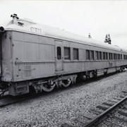
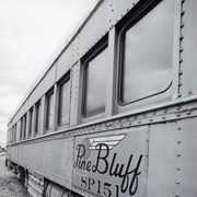
Side view of abandoned caboose of a train. Train is marked with Pine Bluff SP 151 (clearer in photo 2258A). Located on train tracks near First Avenue, between Santa Clara Street and Saint Joseph Street in Arcadia, California. Photo by Terry Miller.
https://arcadiahistory.andornot.com/en/permalink/photographs2379
- Date
- 2001
1 image
- Date
- 2001
- Subjects
- First Avenue
- Railroads
- Southern Pacific
- Trains
- Physical Description
- 4x6 b&w
- ID
- 2257B
- Collection
- Photographs
Images
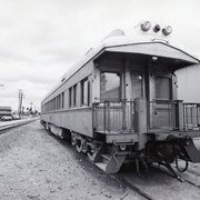
Looking northeast on train tracks near First Avenue, between Santa Clara Street and Saint Joseph Street in Arcadia, California. Building north of the tracks, on left side, is on First Avenue. This was taken at a point east of the abandoned caboose of a train. Train is marked with Pine Bluff SP 151 (clearer in photo 2258A). Photo by Terry Miller.
https://arcadiahistory.andornot.com/en/permalink/photographs2384
- Date
- 2001
1 image
- Date
- 2001
- Subjects
- First Avenue
- Railroads
- Southern Pacific
- Trains
- Physical Description
- 4x6 b&w
- ID
- 2258C
- Collection
- Photographs
Images

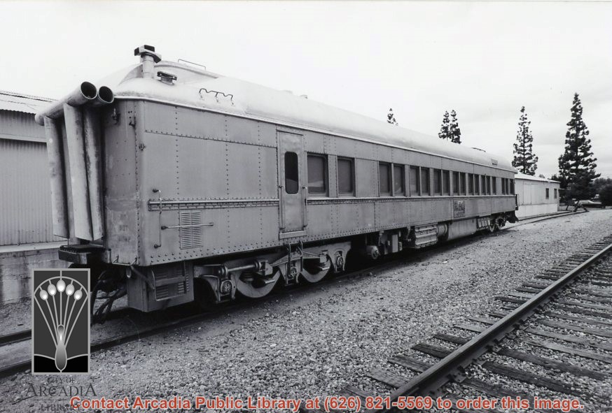
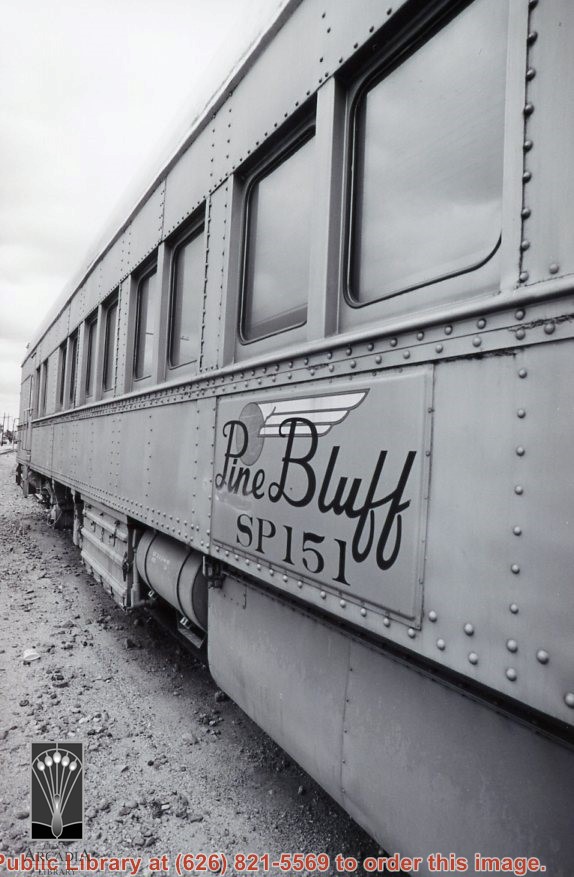
Side view of abandoned caboose of a train. Train is clearly marked with Pine Bluff SP 151. These train tracks are near First Avenue, between Santa Clara Street and Saint Joseph Street in Arcadia, California. Photo by Terry Miller.
https://arcadiahistory.andornot.com/en/permalink/photographs2382
- Date
- 2001
1 image
- Date
- 2001
- Subjects
- First Avenue
- Railroads
- Southern Pacific
- Trains
- Physical Description
- 4x6 b&w
- ID
- 2258A
- Collection
- Photographs
Images
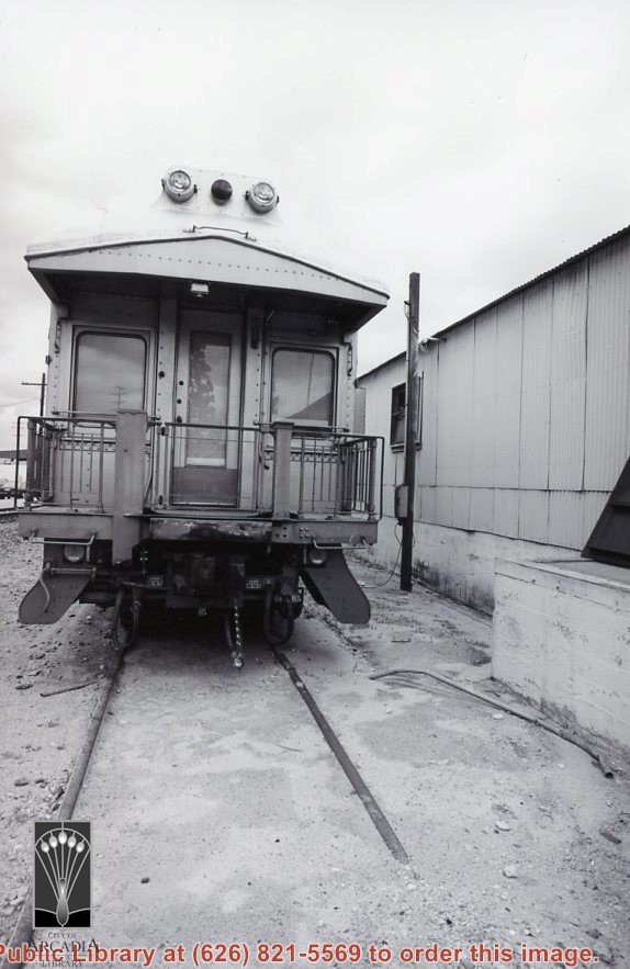
Back and side view of abandoned caboose of a train. Train is marked with Pine Bluff SP 151 (clearer in photo 2258A). Looking northeast on a cloud day, at train tracks near First Avenue, between Santa Clara Street and Saint Joseph Street in Arcadia, California. A building on First Avenue, north of the tracks, is visible. Photo by Terry Miller.
https://arcadiahistory.andornot.com/en/permalink/photographs2378
- Date
- 2001
1 image
- Date
- 2001
- Subjects
- First Avenue
- Railroads
- Southern Pacific
- Trains
- Physical Description
- 4x6 b&w
- ID
- 2257A
- Collection
- Photographs
Images

Another back view of abandoned caboose of a train. Train is marked with Pine Bluff SP 151 (clearer in photo 2258A). Looking northeast on train tracks near First Avenue, between Santa Clara Street and Saint Joseph Street in Arcadia, California. A building on First Avenue, north of the tracks, is barely visible in the background, middle left of photo. Photo by Terry Miller.
https://arcadiahistory.andornot.com/en/permalink/photographs2380
- Date
- 2001
1 image
- Date
- 2001
- Subjects
- First Avenue
- Railroads
- Southern Pacific
- Trains
- Physical Description
- 4x6 b&w
- ID
- 2257C
- Collection
- Photographs
Images