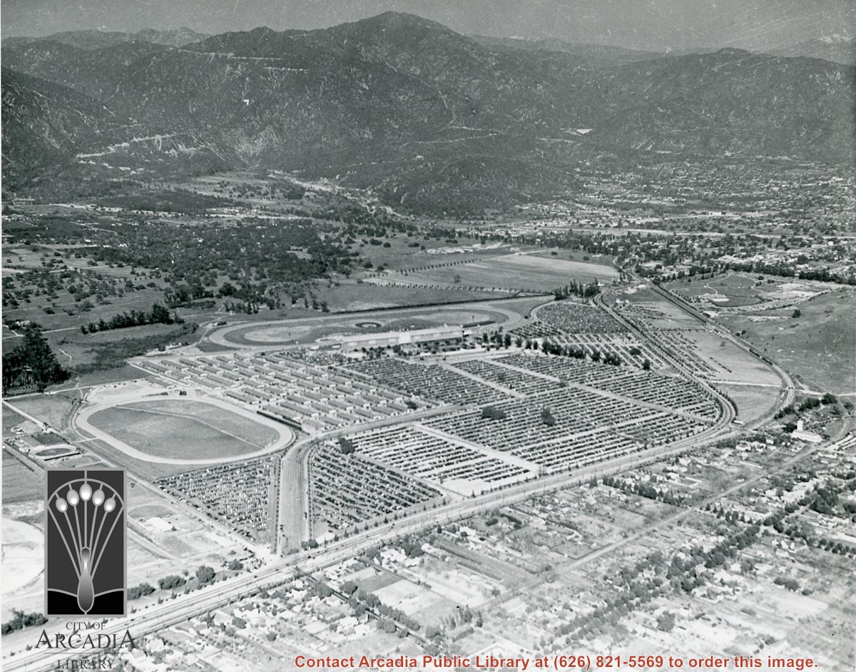
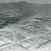
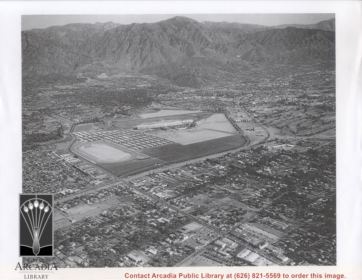
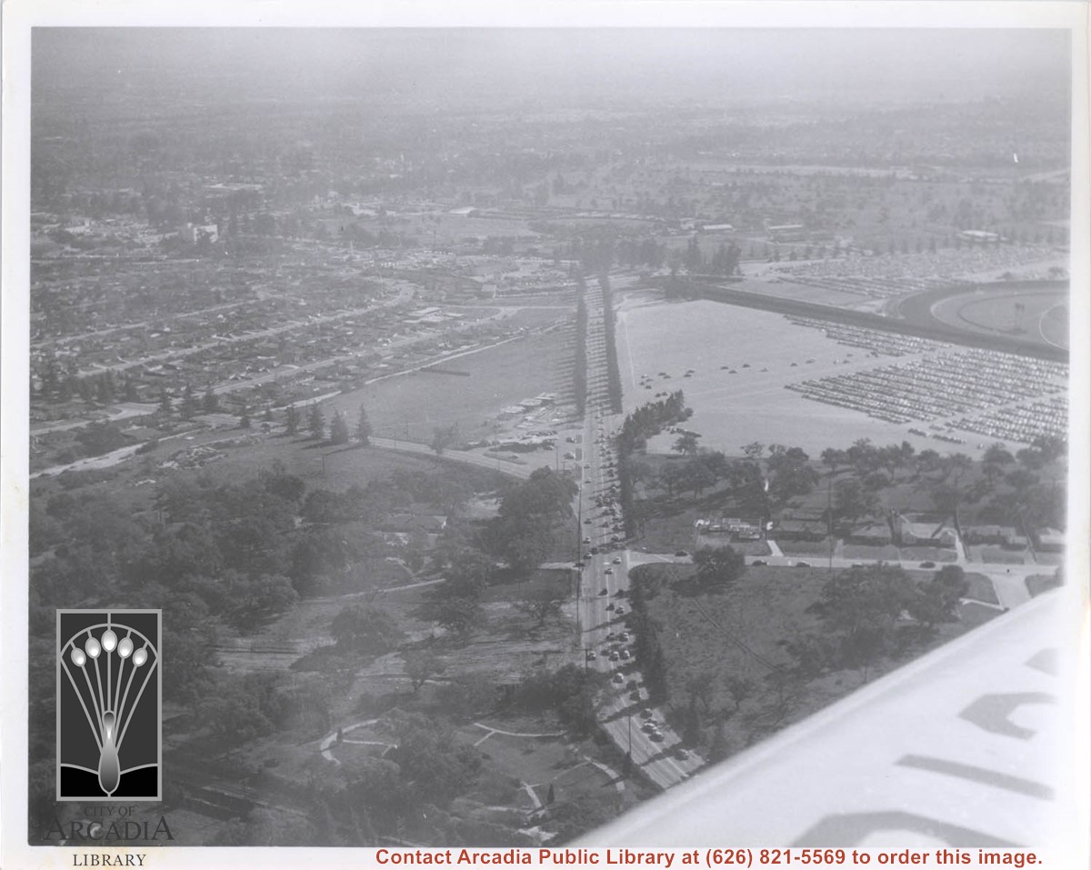
Aerial view looking east across Santa Anita Park taken from a position just west of Baldwin Avenue, which is seen at bottom of photo. Huntington Drive appears exactly in center of photo just east of race track. The 210 Foothill Freeway enters area in upper right portion of picture and exits at left side in upper left portion.
https://arcadiahistory.andornot.com/en/permalink/photographs996
- Date
- c.1979
1 image
- Date
- c.1979
- Subjects
- Aerial Photo Collection
- Aerial views
- 210 Foothill Freeway
- Huntington Drive
- Santa Anita Park-1945-1980
- Physical Description
- 8x10 b&w
- ID
- 989
- Collection
- Photographs
Images


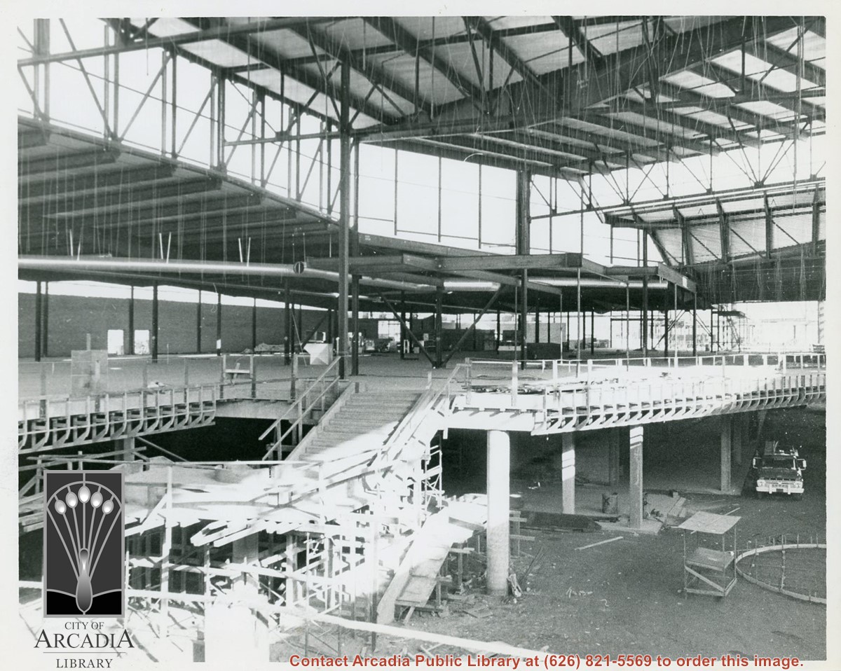
Interior view looking south from north walkway (second level) of Santa Anita Fashion Park during construction.
https://arcadiahistory.andornot.com/en/permalink/photographs948
- Date
- c.1972
1 image
- Date
- c.1972
- Subjects
- Fashion Park
- Physical Description
- 8x10 b&w
- ID
- 942
- Collection
- Photographs
Images
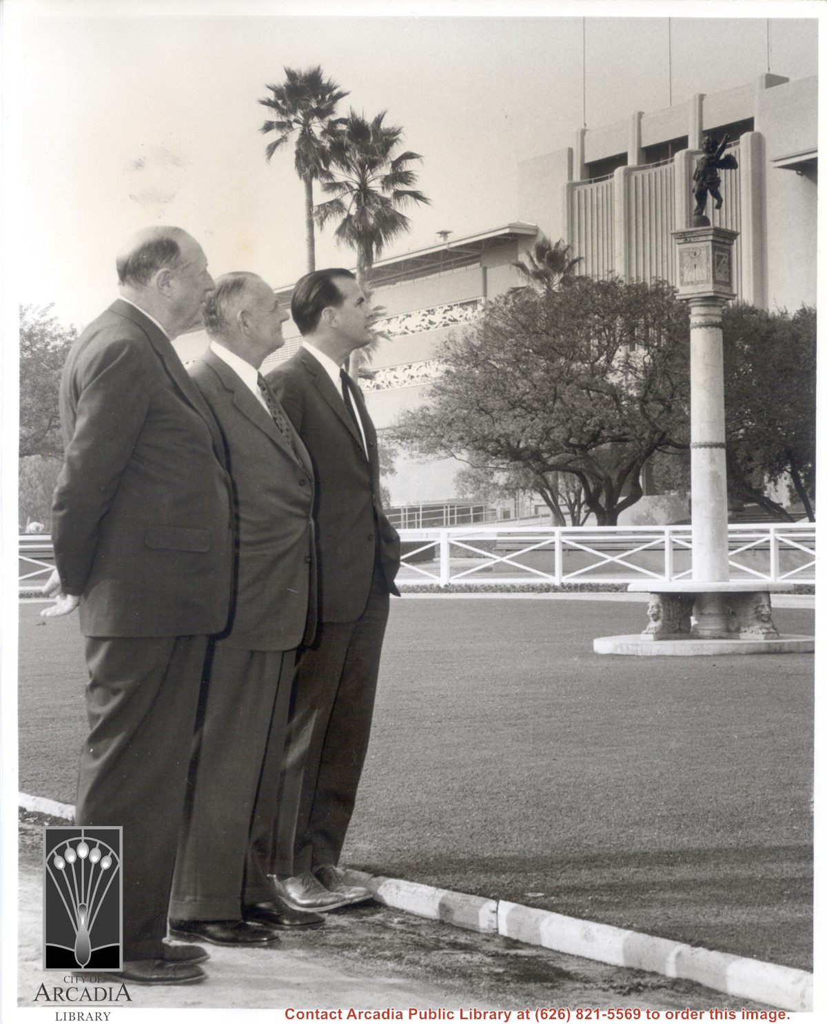
Three men in business suits standing in front of grandstand at Santa Anita Park. They are, L-R: Dr. Charles H. Strub, long time Vice-President and General Manager of the Los Angeles Turf Club and credited with founding of Santa Anita Park; Gwynn Wilson, Treasurer and Assistant General Manager, and Robert P. Strub, manager of operations and later to become head of the Corporation. They are looking at antique column sundial installed in 1956 in center of walking ring.
https://arcadiahistory.andornot.com/en/permalink/photographs982
- Date
- 1956
1 image
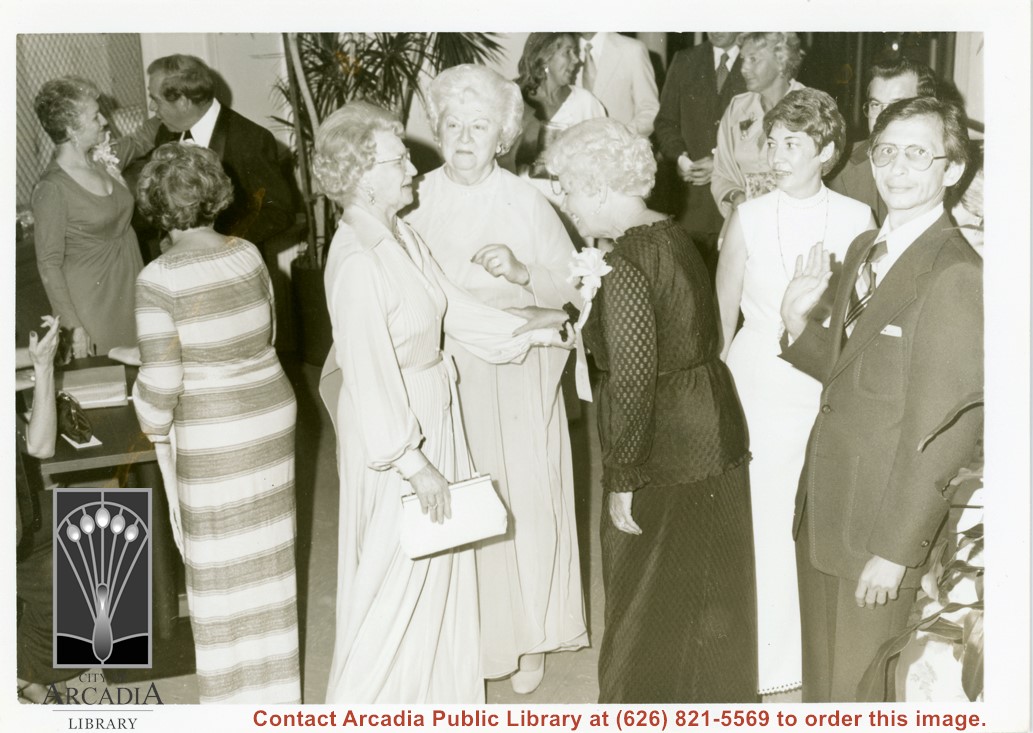
Group pictured at Diamond Jubilee Ball; none are identified. Six are seen in foreground with the others on the perimeter. Man in left foreground has his right hand in a position of greeting.
https://arcadiahistory.andornot.com/en/permalink/photographs744
- Date
- September 30, 1978
1 image
- Date
- September 30, 1978
- Physical Description
- 5x7 b&w
- ID
- 740
- Collection
- Photographs
Images
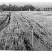
Aerial view taken looking southeast from position about over present Arboretum. Photo shows Santa Anita Park, probably in opening season. Present City Hall sits in area just beyond cars parked at east end of track. Part of oval of old Santa Anita track built by Elias J. "Lucky" Baldwin is seen in upper portion of photo, in area that is now Arcadia County Park. Duarte Road is seen crossing photo in upper right corner. Present Arcadia County Park area is in this photo, bordered on the north by Pacific Electric Railroad tracks. A train has just brought a group to the races and they are seen walking in center of photo. White square seen near right side, is slab left from hangars when U.S. Army Balloon School occupied this site, 1917-1927.
https://arcadiahistory.andornot.com/en/permalink/photographs986
- Date
- c.1934 racing season
1 image
- Date
- c.1934 racing season
- Subjects
- Aerial Photo Collection
- Aerial views
- Arcadia County Park
- Duarte Road
- Race tracks
- Railroads
- Santa Anita Park-1934-1942
- Santa Anita Park-1907-1912
- Physical Description
- 8x10 b&w
- ID
- 978
- Collection
- Photographs
Images


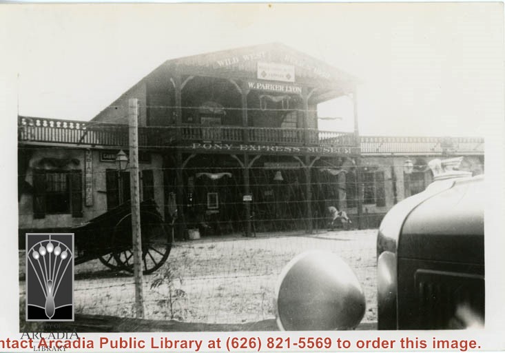
Exterior of the main building of the Pony Express Museum. The photo is taken through a barbed wire fence and is washed out along the upper right corner. The front left part of a car is visible in the right corner.
https://arcadiahistory.andornot.com/en/permalink/photographs1442
- Date
- unknown
1 image
- Date
- unknown
- Subjects
- Pony Express Museum
- Physical Description
- 3x5 b&w
- ID
- 1429
- Collection
- Photographs
Images
In this aerial view looking toward the east, the oval directly in the center of photo was a training track belonging to Santa Anita. This was removed to make room for the Fashion Park mall. The small circular track across what is now Baldwin Avenue and the oval track farther south belonged to a private riding stable. The remains of the Los Angeles Jockey Club Track which Joe Smoot and Anita Baldwin started but did not complete in 1933, can be seen in lower right corner. This photo belongs to the Huntington Library. It is shown here for research only.
https://arcadiahistory.andornot.com/en/permalink/photographs628
- Date
- c. 1935
1 image
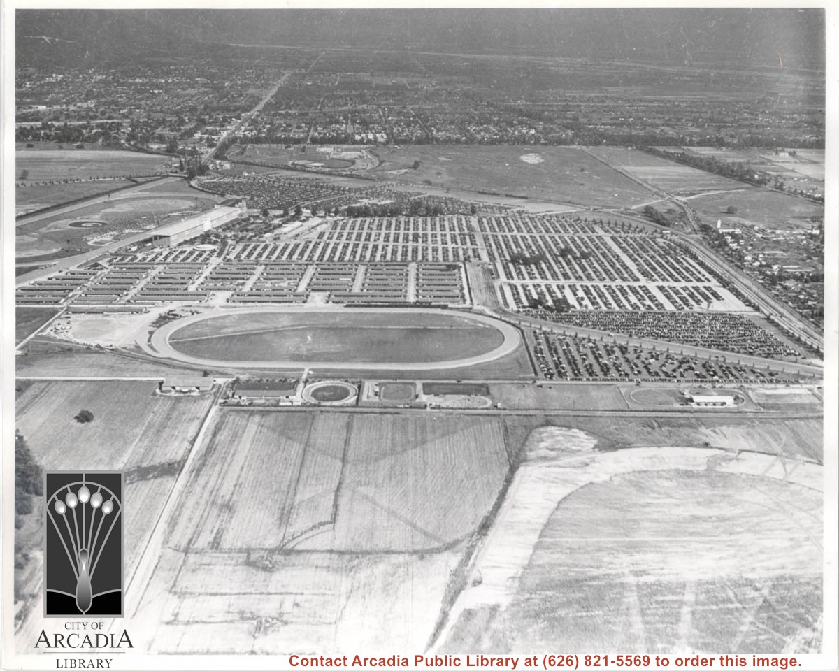
Santa Anita Park Race Track just right of center at south edge of photo. Oval to the left of Santa Anita Park Race Track was training track which was removed to make room for Santa Anita Fashion Park (currently Westfield Santa Anita Shopping Mall). Street just to left of training track is Baldwin Avenue. Huntington Drive and Colorado Place form a "y" just east of Santa Anita Park Race Track. Along both can be noticed the conifer trees planted a few years earlier. Street completely bisecting photo just below center is Foothill Boulevard, next one is Orange Grove Avenue. Santa Anita Avenue is partially in view on right edge of photo. Oval on extreme lower left side of photo is old Baldwin training track. Baseball diamond in lower right corner is at Arcadia County Park. Scale: 1"=660'
https://arcadiahistory.andornot.com/en/permalink/photographs620
- Date
- June 5, 1938
1 image
- Date
- June 5, 1938
- Subjects
- Aerial Photo Collection
- Aerial views
- Baldwin Avenue
- Colorado Boulevard
- Colorado Place
- Colorado Street
- Foothill Boulevard
- Huntington Drive
- Orange Grove Avenue
- Santa Anita Fashion Park (later known as Westfield Santa Anita)
- Santa Anita Park-1934-1942
- Physical Description
- 8x10 b&w
- ID
- 616
- Collection
- Photographs
Images


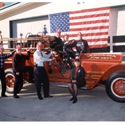
City Department Heads pose with vintage Arcadia Fire Department truck, each one wearing a fire department hat. From left to right: Don Penman, Jerry Collins, Dave Hinig, Bill Kelly (behind steering wheel), Tracy Hause, Pat Malloy, Janet Sporleder (seated on running board).
https://arcadiahistory.andornot.com/en/permalink/photographs1747
- Date
- December 2001
1 image
- Date
- December 2001
- Subjects
- Vintage fire truck
- Arcadia Fire Department
- Department heads-department managers
- Penman, Don
- Collins, Jerry
- Hinig, Dave
- Kelly, Bill
- Hause, Tracy
- Malloy, Pat
- Sporleder, Janet
- Physical Description
- 8 x 10 color
- ID
- 1735
- Collection
- Photographs
Images

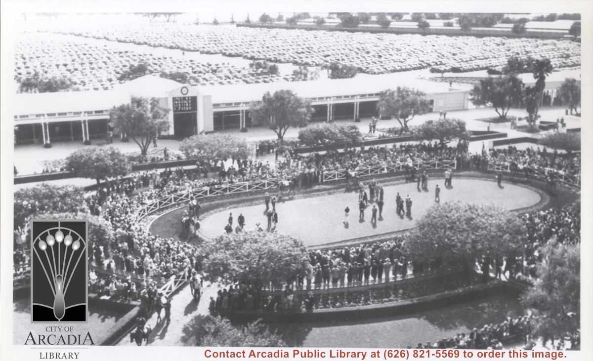
Very large crowd is seen in this photo taken from upper floors of Club House at Santa Anita Park. Focus is particularly on walking ring where a number of horses are with their handlers.
https://arcadiahistory.andornot.com/en/permalink/photographs993
- Date
- c.1940
1 image
- Date
- c.1940
- Subjects
- Santa Anita Park-1934-1942
- Physical Description
- 3x5 b&w
- ID
- 986
- Collection
- Photographs
Images
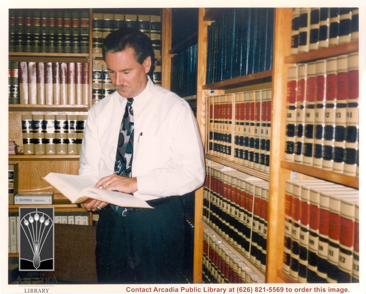
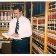
Arcadia City Manager Bill Kelly is seen standing in front of book cases in the office of the City Attorney. He is wearing a white shirt and tie and is looking down at a book in his hands. Photo was taken by Dorothy Denne of the Arcadia Weekly to be used in a display at the Library for National Library Week.
https://arcadiahistory.andornot.com/en/permalink/photographs1517
- Date
- March 1997
1 image
- Date
- March 1997
- Subjects
- Kelly, Bill
- Physical Description
- 8x10 color
- ID
- 1501
- Collection
- Photographs
Images
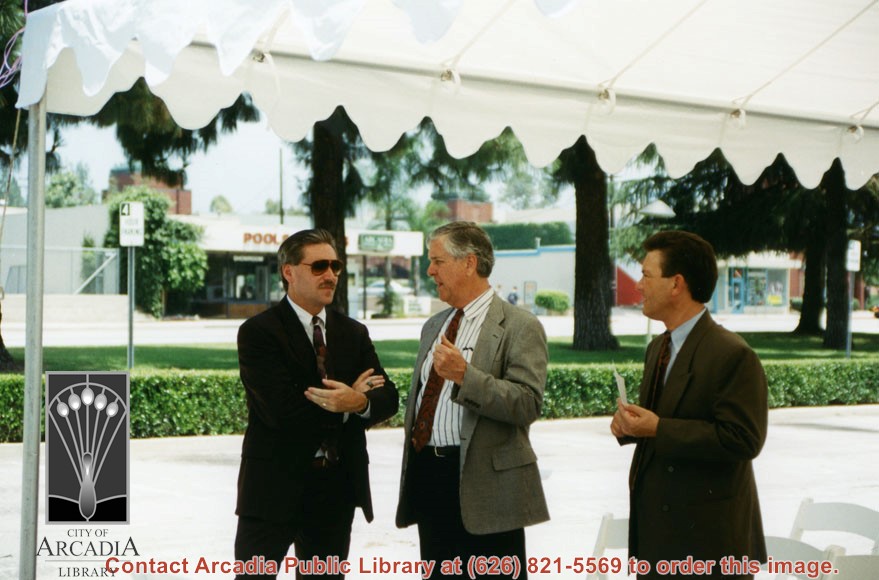
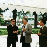
Groundbreaking ceremonies for the remodel/expansion project at Arcadia Public Library, 20 W. Duarte Road. This photo shows City Manager Bill Kelly on the left with Charles Walton in the center and Jim Nardini on the right.
https://arcadiahistory.andornot.com/en/permalink/photographs1495
- Date
- June, 1995
1 image
Aerial view toward north from a position south of Huntington Drive near intersection with Baldwin Avenue. It shows Santa Anita Fashion Park (currently known as Westfield Santa Anita Shopping Mall) developed by and on property owned by Santa Anita Consolidated. The Santa Anita Park Race Track and club house can be seen in center of photo. The straight white line about one inch above the club house roof is 210 Foothill Freeway. Chantry Flats road can be seen going up into San Gabriel Mountains in distance.
https://arcadiahistory.andornot.com/en/permalink/photographs646
- Date
- c. 1975
1 image
- Date
- c. 1975
- Subjects
- Aerial Photo Collection
- Aerial views
- 210 Foothill Freeway
- Chantry Flats Road
- Malls
- San Gabriel Mountains
- Santa Anita Park-1945-1980
- Santa Anita Fashion Park
- Westfield Santa Anita Shopping Mall
- Physical Description
- 8x10 b&w
- ID
- 642
- Collection
- Photographs
Images


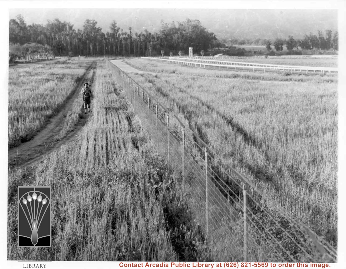
Lone army sentry patrolling outside fence of Santa Anita Assembly Center for the Japanese. White fencing encloses training track which was located alongside Baldwin Avenue, approximately where west parking area for Fashion Park (now Westfield Santa Anita mall) is now. Palm trees seen on left side, would be on grounds of present Arboretum.
https://arcadiahistory.andornot.com/en/permalink/photographs661
- Date
- April 1942
1 image
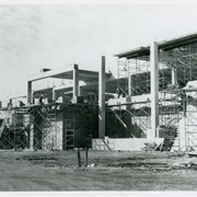
Construction on Santa Anita Fashion Park is well along in this view of exterior, SE corner.
https://arcadiahistory.andornot.com/en/permalink/photographs949
- Date
- c.1972
1 image
- Date
- c.1972
- Subjects
- Fashion Park
- Physical Description
- 8x10 b&w
- ID
- 943
- Collection
- Photographs
Images

Aerial view toward NE. Main thoroughfare cutting across east to west with young trees planted on north side, is Huntington Drive. Main race track at Santa Anita is seen almost directly in center of photo, with Club House on side closest to camera. The smaller oval near left edge of photo was a training track belonging to Santa Anita which was removed for the Fashion Park. The Chantry Flats Road up to Santa Anita Canyon is clearly seen as it zig-zags around San Gabriel Mountains. This photo belongs to the Huntington Library. It is shown here for research only.
https://arcadiahistory.andornot.com/en/permalink/photographs629
- Date
- c. 1940s
1 image
- Date
- c. 1940s
- Subjects
- San Gabriel Mountains
- Santa Anita Park-1934-1942
- Chantry Flats Road
- Huntington Drive
- Fashion Park
- Physical Description
- 8x10 b&w
- ID
- 625
- Collection
- Photographs
Images
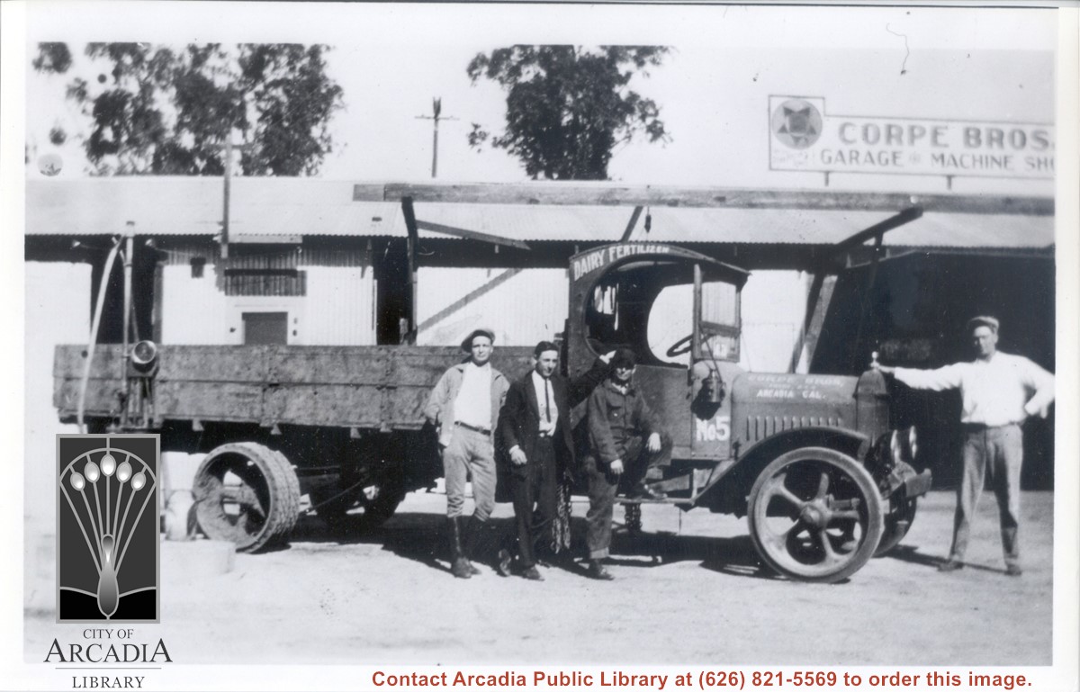
Corpe brothers garage and machine shop with truck parked in front of shop at 50 La Porte Street, Arcadia. Standing by truck, left to right: Enos Corpe, ?, Bill Cooper, mechanic, and Clint Corpe with hand on front of truck. Truck has printed on it: Dairy Fertilizer, which was another business run by the Corpe brothers.
https://arcadiahistory.andornot.com/en/permalink/photographs369
- Date
- c.1919
1 image
- Date
- c.1919
- Subjects
- Corpe, Enos
- Corpe, Clint
- Cooper, Bill
- Corpe Brothers Garage & Machine Shop
- Business & industry
- Physical Description
- 7x10 b&w
- ID
- 367
- Collection
- Photographs
Images
Aerial view looking towards San Gabriel Mountains showing intersection of Baldwin Avenue and Huntington Drive, the Santa Anita Park and training track where Santa Anita Fashion Park (currently known as Westfield Santa Anita Shopping Mall) was built.
https://arcadiahistory.andornot.com/en/permalink/photographs1754
- Date
- Unknown
1 image
- Date
- Unknown
- Subjects
- Aerial Photo Collection
- Aerial views
- Baldwin Avenue
- Huntington Drive
- Malls
- San Gabriel Mountains
- Santa Anita Fashion Park
- Santa Anita Park, 1945-1980
- Westfield Santa Anita Shopping Mall
- Physical Description
- 8x10 b&w photocopy
- ID
- 1742
- Collection
- Photographs
Images
Aerial view south on Colorado Street just over large turn to the west. The residential area known as Santa Anita Gardens shows along upper left section of photo. Note that the only commerical development along the north side of Colorado Street is the Westerner Motel just near intersection with Huntington Drive. Santa Fe Railroad tracks are seen in lower left corner of photo. Santa Anita Park Race Track is on right.
https://arcadiahistory.andornot.com/en/permalink/photographs641
- Date
- c. 1956
1 image
- Date
- c. 1956
- Subjects
- Aerial Photo Collection
- Aerial views
- Colorado Boulevard
- Colorado Street
- Huntington Drive
- Railroads
- Santa Anita Park-1945-1980
- Westerner Motel
- Physical Description
- 8x10 b&w
- ID
- 637
- Collection
- Photographs
Images
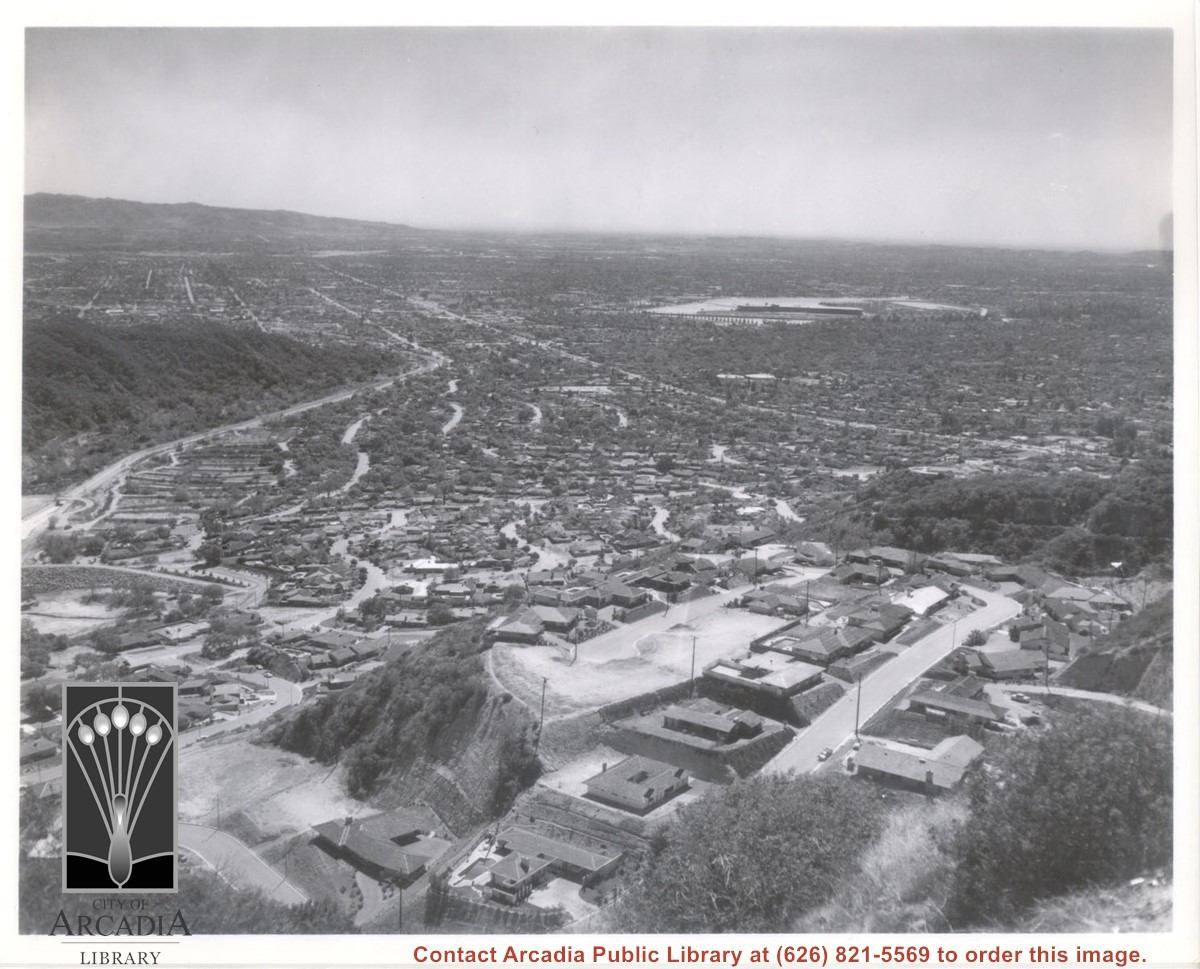
Aerial view south from Chantry Flats Road over the still-developing upper Highlands section of Arcadia. View is across Arcadia toward the Puente Hills. Santa Anita Park Race Track is seen in the center. Santa Anita Wash is seen on extreme left.
https://arcadiahistory.andornot.com/en/permalink/photographs955
- Date
- c.1965
1 image
- Date
- c.1965
- Subjects
- Aerial Photo Collection
- Aerial views
- Arcadia(City)-History-1960-1969
- Chantry Flats Road
- Santa Anita Wash
- Physical Description
- 8x10 b&w
- ID
- 949
- Collection
- Photographs
Images