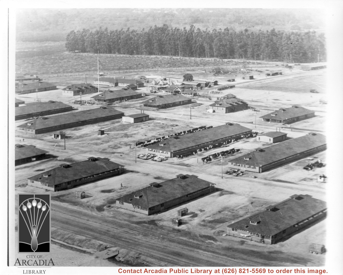
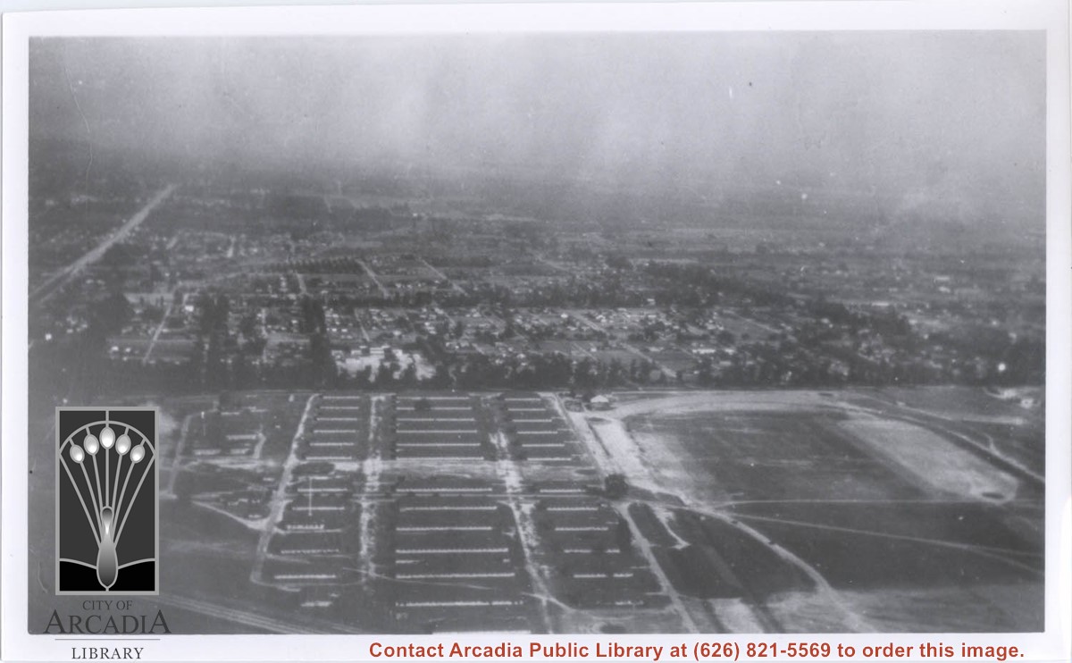
Aerial view, apparently looking northeast, of major portion of Ross Field. Four large barracks-type buildings are along in a row in foreground. There are two other rows of buildings, with flag pole in third row of buildings. Large stand of eucalyptus across background.
https://arcadiahistory.andornot.com/en/permalink/photographs229
- Date
- c.1918
1 image
- Date
- c.1918
- Subjects
- Balloon School
- Physical Description
- 9x11 b&w
- ID
- 227
- Collection
- Photographs
Images
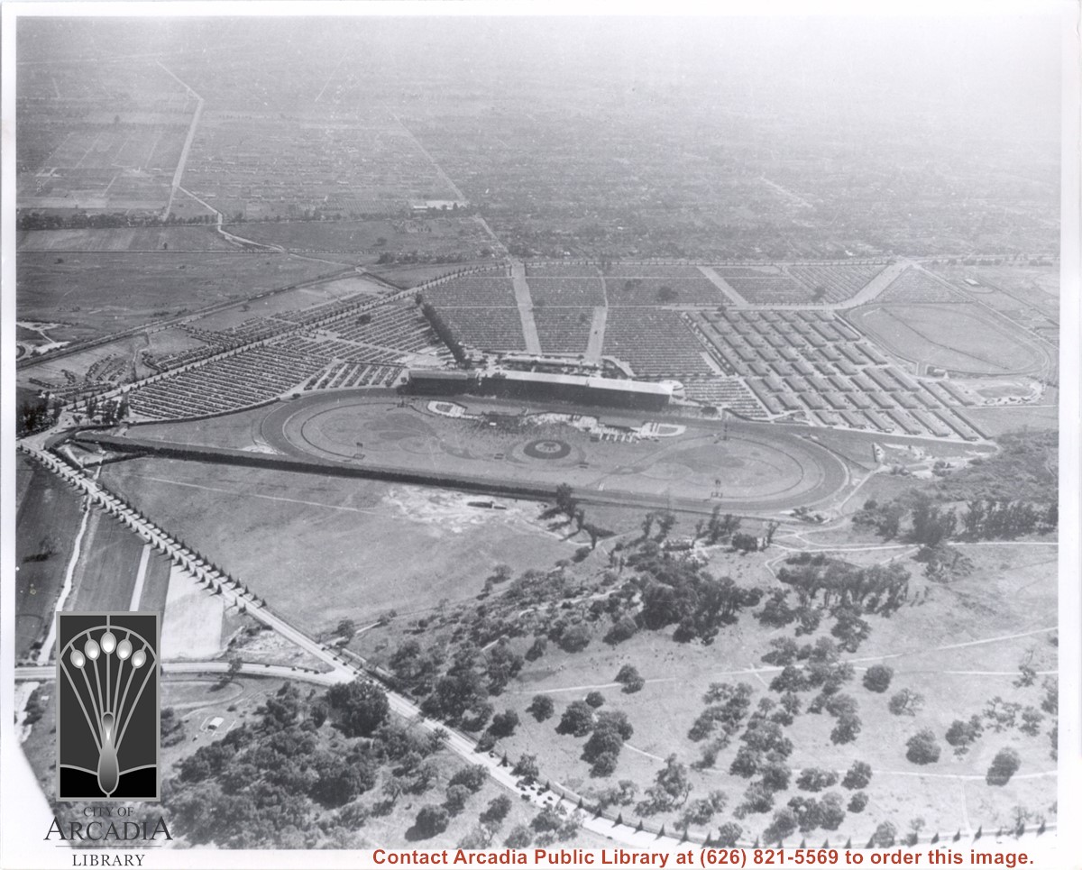
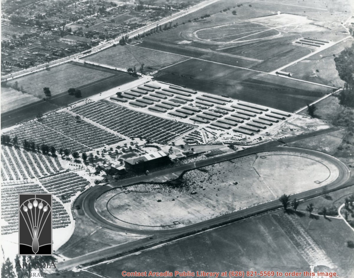
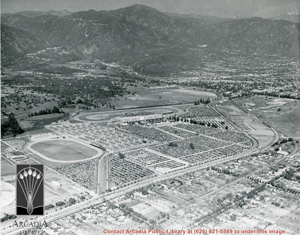
Aerial view due south from a position almost directly over sharp curve of Colorado Street. Showing in this photo are the Track and Club House on a day of large attendance, the stables, and a training track. All along Huntington Drive and Colorado Street young trees have been planted. Old-time resident Reid Greer says that the large tree at the very left edge of photo about 2 1/2 in. from bottom is same tree as seen in photo #654, on flat ground just below knolls seen here, and therefore he places homes of Indians on ranch at this spot. E.J."Lucky" Baldwin winery is only building seen on knoll. There is an "x" on reverse side to mark location. This photo belongs to the Huntington Library. It is shown here for research only.
https://arcadiahistory.andornot.com/en/permalink/photographs632
- Date
- c. 1935
1 image
- Date
- c. 1935
- Subjects
- Baldwin, Elias J. "Lucky"-Wines and winemaking
- Colorado Blvd
- Colorado Street
- Huntington Drive
- Santa Anita Park-1934-1942
- Physical Description
- 8x10 b&w
- ID
- 628
- Collection
- Photographs
Images
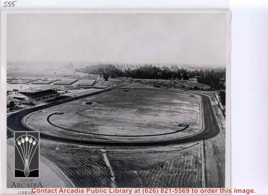
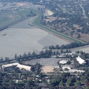
Aerial view from east looking west over Santa Anita Race Track shortly after its opening. Baldwin Avenue shows just faintly as a white line above track barns. Note total absence of homes in what we call Santa Anita Village and Lower Rancho.
https://arcadiahistory.andornot.com/en/permalink/photographs559
- Date
- c. December 1934
1 image
- Date
- c. December 1934
- Subjects
- Santa Anita Park-1934-1942
- Physical Description
- 8x10 b&w
- ID
- 555
- Collection
- Photographs
Images
Aerial view looking east across Santa Anita Park taken from a position just west of Baldwin Avenue, which is seen at bottom of photo. Huntington Drive appears exactly in center of photo just east of race track. The 210 Foothill Freeway enters area in upper right portion of picture and exits at left side in upper left portion.
https://arcadiahistory.andornot.com/en/permalink/photographs996
- Date
- c.1979
1 image
- Date
- c.1979
- Subjects
- Aerial Photo Collection
- Aerial views
- 210 Foothill Freeway
- Huntington Drive
- Santa Anita Park-1945-1980
- Physical Description
- 8x10 b&w
- ID
- 989
- Collection
- Photographs
Images


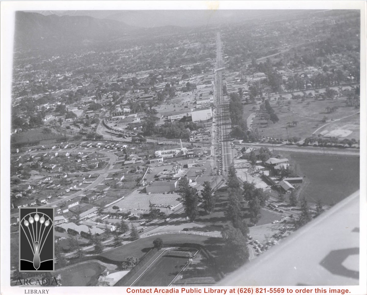
Aerial view looking east along Huntington Drive taken over the Club House at Santa Anita Park Race Track. Pony Express Museum is just to right of the "y" intersection of Huntington Drive coming into Arcadia just below the wing of the plane. Theater that was opened in 1942 is almost directly opposite Museum. Santa Anita Motor Inn, two buildings east of theater, distinguished by tall tower, opened in 1938. (It was torn down in 1975.) The residential area directly north of there is known as Santa Anita Gardens. Santa Anita Avenue is just beyond Arcadia County Park on right.
https://arcadiahistory.andornot.com/en/permalink/photographs642
- Date
- c. 1957-58
1 image
- Date
- c. 1957-58
- Subjects
- Aerial Photo Collection
- Aerial views
- Huntington Drive
- Pony Express Museum
- Santa Anita Avenue
- Santa Anita Motor Inn
- Physical Description
- 8x10 b&w
- ID
- 638
- Collection
- Photographs
Images
Aerial view. Looking east. Street along right edge of photo which is lined with trees is Duarte Road. Santa Anita Avenue cuts across photo from right to left and up into the San Gabriel Mountains. Huntington Drive can be seen in center of photo with young trees planted on north side of it. Santa Anita Race Track is one furthest from camera. The next small track is a training track belonging to Santa Anita. There is a VERY small round track across the street from the training track, which was part of a private horse stables. The incompleted oval was part of work done in 1933 by Joe Smoot and Anita Baldwin in their effort to develop the Jockey Club Track. This photo belongs to the Huntington Library. It is shown here for research only.
https://arcadiahistory.andornot.com/en/permalink/photographs627
- Date
- c. 1935
1 image
- Date
- c. 1935
- Subjects
- Duarte Road
- Huntington Drive
- Los Angeles Jockey Club
- San Gabriel Mountains
- Santa Anita Park-1934-1942
- Physical Description
- 8x10 b&w
- ID
- 623
- Collection
- Photographs
Images
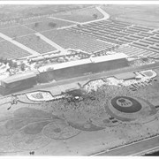
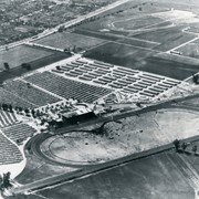
Aerial view looking south over Santa Anita Race Track on a day of very heavy attendance. The floral plantings which form designs in the in-field are shown clearly. Also seen are: the clubhouse, the stables, and the training track. These latter were either moved or done away with to make way for the Fashion Park. Main gate was at NE corner of Huntington Drive and Baldwin, which was not cut through at that time. This photo belongs to the Huntington Library. It is shown here for research only.
https://arcadiahistory.andornot.com/en/permalink/photographs631
- Date
- c. 1935
1 image

Aerial view looking west across Santa Anita Park from a position about Santa Anita Avenue just north of Huntington Drive. In the upper right portion of the photo can be seen the extensive earthwork done for the track Anita Baldwin and Joe Smoot planned to build. That vast area now is entirely built with homes and apartments and is called Santa Anita Village. Present-day Baldwin Avenue would follow the line shown by the Ranch Road bisecting the photo from right to left just east of the track abandoned by Anita Baldwin and Joe Smoot.
https://arcadiahistory.andornot.com/en/permalink/photographs985
- Date
- c.1934
1 image
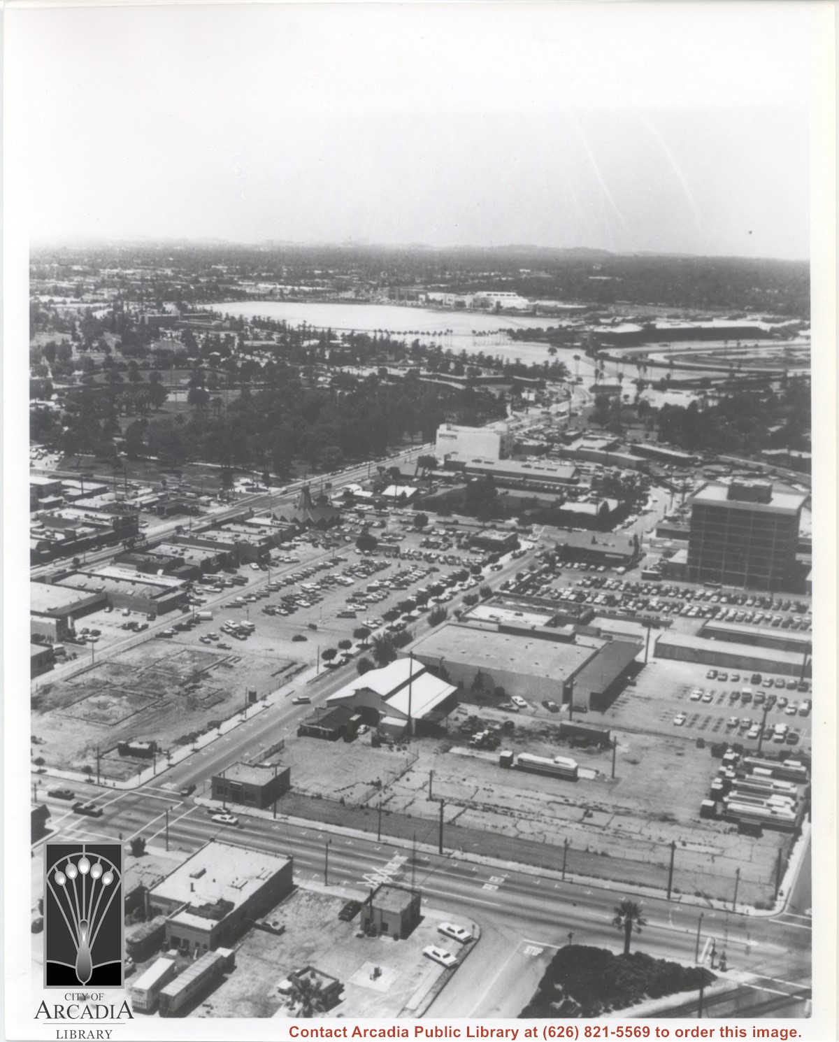
Aerial view looking west from a position approximately over Santa Fe railroad tracks between First Avenue and Second Avenue. Street closest to camera is First Avenue, running north/south, and we see its intersection with Wheeler Avenue in lower left portion of photo. Almost vacant lot on northwest corner of Wheeler Avenue and First Avenue is where Sawmill Restaurant was built in about 1977 (Sawmill Restaurant closed in early 1990's). Foundation work on South side of Wheeler Avenue at corner of First Avenue is for medical building which became 65 N. First Avenue. (Former site of Arcadia Public Library until 1961.) Post Office is largest building in center of the block on north side of Wheeler Avenue. Large white area is parking area for Santa Anita Park Race Track.
https://arcadiahistory.andornot.com/en/permalink/photographs640
- Date
- July 1976
1 image
- Date
- July 1976
- Subjects
- Aerial Photo Collection
- Aerial views
- First Avenue
- Postal Service
- Santa Anita Park-1945-1980
- United States Post Office
- Wheeler Avenue
- Physical Description
- 8x10 b&w
- ID
- 636
- Collection
- Photographs
Images
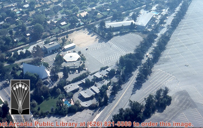
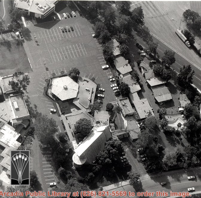
Aerial view, of Santa Anita Park Race Track in the upper left quadrant (address is 285 West Huntington Drive) and the white A-Frame roof of Santa Anita Church (address is 226 West Colorado Boulevard) in the lower right quadrant. A six-sided, hexagon building seen to the left of Santa Anita Church, is the Fireside Room and Fellowship Hall, which is part of the Santa Anita Church. Any use of this image must be credited "Photograph by David Stevens. Copyright David Stevens."
https://arcadiahistory.andornot.com/en/permalink/photographs2416
- Date
- 1990?
1 image
- Date
- 1990?
- Subjects
- Aerial Photo Collection
- Aerial views
- David Stevens Collection
- Santa Anita Church
- Santa Anita Park
- Physical Description
- color image, digital, see i:images
- ID
- 2274
- Collection
- Photographs
Images

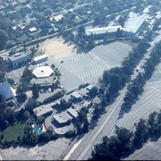
Aerial view, of the white A-Frame roof of Santa Anita Church (address is 226 West Colorado Boulevard, Arcadia, California). A six-sided, hexagon building near Santa Anita Church is the Fireside Room and Fellowship Hall, which is part of the Santa Anita Church. Any use of this image must be credited "Photograph by David Stevens. Copyright David Stevens."
https://arcadiahistory.andornot.com/en/permalink/photographs2420
- Date
- 1990?
1 image
- Date
- 1990?
- Physical Description
- color image, digital, see i:images
- ID
- 2278
- Collection
- Photographs
Images
Aerial view, of the white A-Frame roof of Santa Anita Church (address is 226 West Colorado Boulevard, Arcadia, California). A six-sided, hexagon building near Santa Anita Church is the Fireside Room and Fellowship Hall, which is part of the Santa Anita Church. The church property goes all the way to Colorado Place (including "The Village Apartments," formerly the Frontier Motel, which the church purchased in 1972) and includes the parking lot and the building at the top of the photo, the Margaret Stevens Center. Any use of this image must be credited "Photograph by David Stevens. Copyright David Stevens."
https://arcadiahistory.andornot.com/en/permalink/photographs2421
- Date
- 1990?
1 image
- Date
- 1990?
- Physical Description
- color image, digital, see i:images
- ID
- 2279
- Collection
- Photographs
Images
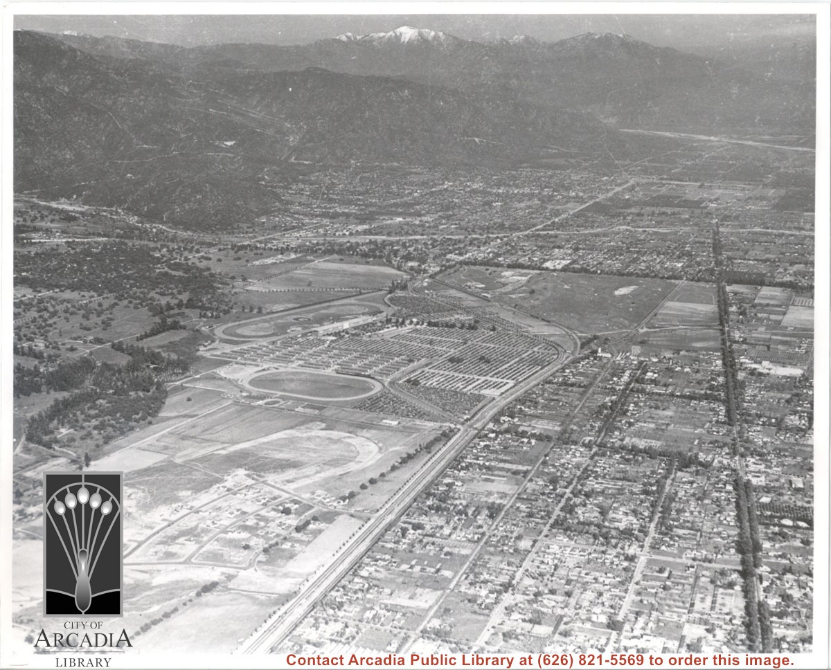
Aerial view toward NE. Main thoroughfare cutting across east to west with young trees planted on north side, is Huntington Drive. Main race track at Santa Anita is seen almost directly in center of photo, with Club House on side closest to camera. The smaller oval near left edge of photo was a training track belonging to Santa Anita which was removed for the Fashion Park. The Chantry Flats Road up to Santa Anita Canyon is clearly seen as it zig-zags around San Gabriel Mountains. This photo belongs to the Huntington Library. It is shown here for research only.
https://arcadiahistory.andornot.com/en/permalink/photographs629
- Date
- c. 1940s
1 image
- Date
- c. 1940s
- Subjects
- San Gabriel Mountains
- Santa Anita Park-1934-1942
- Chantry Flats Road
- Huntington Drive
- Fashion Park
- Physical Description
- 8x10 b&w
- ID
- 625
- Collection
- Photographs
Images
Aerial view toward NE. Plane is over property of Charles W. Stewart (10 acres), and Jaspar Teague (10 acres), at 1320 S. Santa Anita Avenue, which is directly under the plane. Next street east is First Avenue, then Second Avenue, the Fourth Avenue. Reservoir is at corner of Valnett Avenue and Second Avenue and was owned by Walnut Grove Mutual Water Company (Valnett Avenue was first through street south of Duarte Road at this time and became Camino Real).
https://arcadiahistory.andornot.com/en/permalink/photographs644
- Date
- November 1929
1 image
- Date
- November 1929
- Subjects
- Aerial Photo Collection
- Aerial views
- Camino Real
- Duarte Road
- First Avenue
- Fourth Avenue
- Second Avenue
- Santa Anita Avenue (South)
- Stewart, Charles W.
- Teague, Jaspar
- Valnett Avenue
- Physical Description
- 6x10 b&w
- ID
- 640
- Collection
- Photographs
Images


Aerial view toward north from a position south of Huntington Drive near intersection with Baldwin Avenue. It shows Santa Anita Fashion Park (currently known as Westfield Santa Anita Shopping Mall) developed by and on property owned by Santa Anita Consolidated. The Santa Anita Park Race Track and club house can be seen in center of photo. The straight white line about one inch above the club house roof is 210 Foothill Freeway. Chantry Flats road can be seen going up into San Gabriel Mountains in distance.
https://arcadiahistory.andornot.com/en/permalink/photographs646
- Date
- c. 1975
1 image
- Date
- c. 1975
- Subjects
- Aerial Photo Collection
- Aerial views
- 210 Foothill Freeway
- Chantry Flats Road
- Malls
- San Gabriel Mountains
- Santa Anita Park-1945-1980
- Santa Anita Fashion Park
- Westfield Santa Anita Shopping Mall
- Physical Description
- 8x10 b&w
- ID
- 642
- Collection
- Photographs
Images


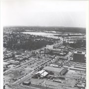
Aerial view toward the east taken from about over present Club House at Santa Anita Park Race Track. The main street running North/South is Santa Anita Avenue. View shows the oval of Elias J. "Lucky" Baldwin's race track in what is currently Arcadia County Park. The buildings would be barracks of Ross Field U.S. Army Balloon School. Duarte Road can be seen coming into photo at right edge of photo near intersection with Santa Anita Avenue. The broad street along left side would be Huntington Drive. Railroad tracks can be seen in lower left corner.
https://arcadiahistory.andornot.com/en/permalink/photographs635
- Date
- November 1929
1 image
- Date
- November 1929
- Subjects
- Aerial Photo Collection
- Aerial views
- Balloon School
- Huntington Drive
- Race tracks
- Railroads
- Santa Anita Avenue
- Physical Description
- 6x10 b&w
- ID
- 631
- Collection
- Photographs
Images

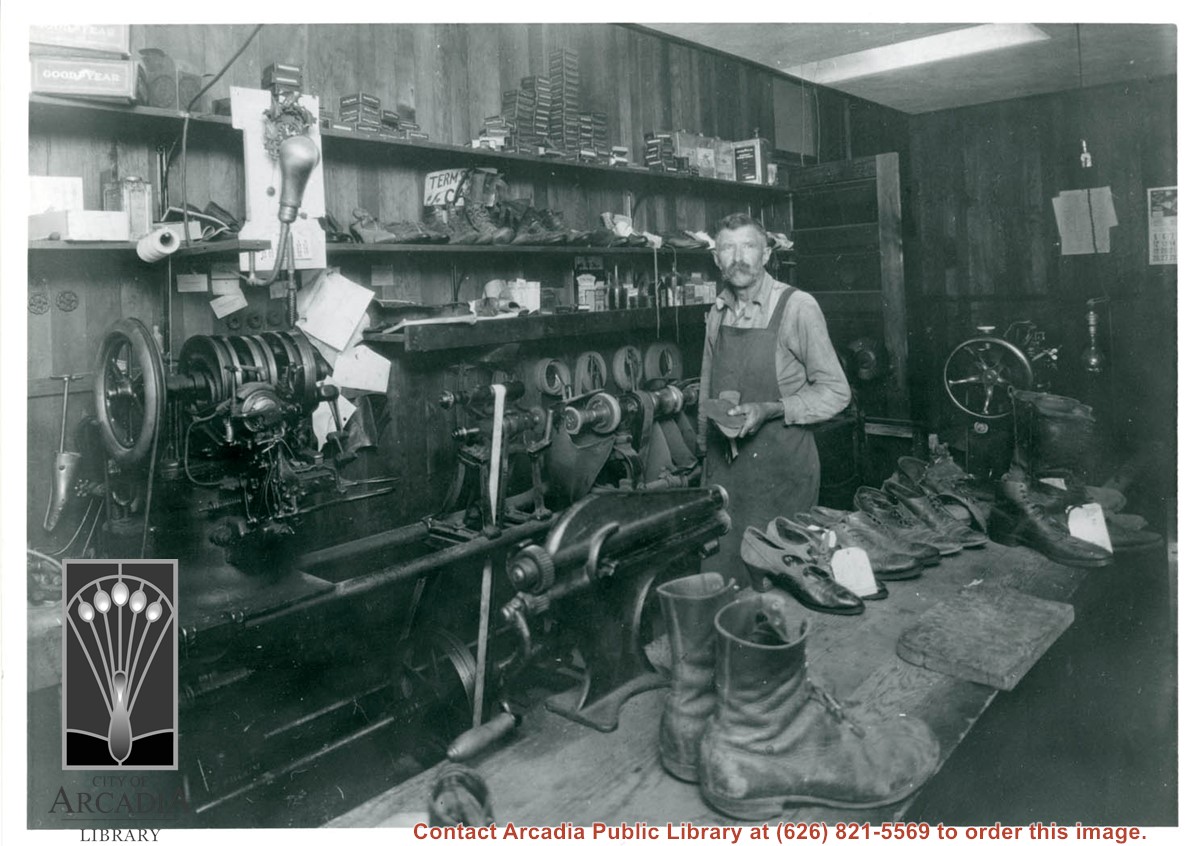
Al Yarter, shoemaker, at his shoe shop which was in building he built in 300 block of N. First Ave. on west side of street. Photo #855 shows exterior of shop.
https://arcadiahistory.andornot.com/en/permalink/photographs862
- Date
- 1923
1 image
- Date
- 1923
- Subjects
- Arcadia Shoe Shop
- Yarter, Al
- Physical Description
- 8x10 b&w
- ID
- 856
- Collection
- Photographs
Images
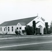
American Lutheran Church, then at 1424 S. Baldwin, which was later home of Serbian Orthodox Church. Building was dedicated Nov. 12, 1939, enlarged in 1945 and sold in 1963 to Serbian Orthodox, when Lutheran congregation's new church was built on Duarte Road.
https://arcadiahistory.andornot.com/en/permalink/photographs235
- Date
- c.1948
1 image

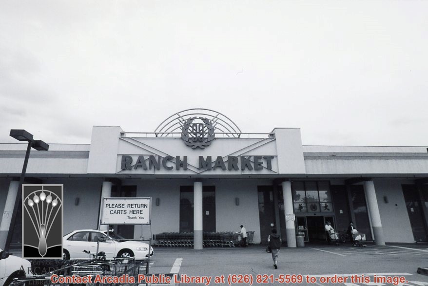
Another exterior view of 99 Ranch Market, a Chinese market at Duarte Road and Golden West Avenue, showing shoppers going in and out of entrance. Address is 1300 South Golden West Avenue in Arcadia. Photograph by Terry Miller.
https://arcadiahistory.andornot.com/en/permalink/photographs2292
- Date
- c. April 2001
1 image
- Date
- c. April 2001
- Subjects
- Markets
- 99 Ranch Market
- Grocery stores
- Physical Description
- 4x6 b&w
- ID
- 2236C
- Collection
- Photographs
Images
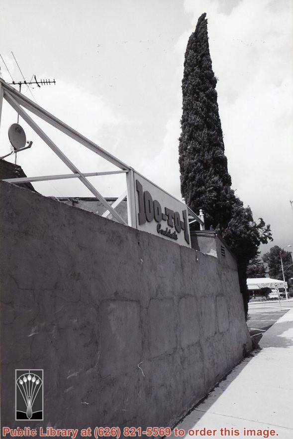
Another exterior view of 100-to-1 cocktail bar at 100 W. Huntington Drive. This horse racing themed bar was demolished 2015. Murals inside were salvaged by Gilb Museum. Photograph by Terry Miller.
https://arcadiahistory.andornot.com/en/permalink/photographs2286
- Date
- c. April 2001
1 image
- Date
- c. April 2001
- Subjects
- Clubs
- Restaurants, bars, etc.
- Physical Description
- 4x6 b&w
- ID
- 2235A
- Collection
- Photographs
Images